Joaquín Suárez night lights from space
Night Light of Joaquín Suárez (Canelones) from space (Uruguay) Src. Average luminocity for 10x10km area is 46.3022% and for 50x50km: 28.2665%.
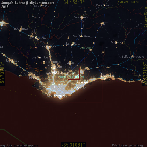
Analysis of Joaquín Suárez night lights 2016
Square area 10x10 km:
 2.38%
2.38%90-99
3.11%80-89
6.04%70-79
5.31%60-69
10.81%50-59
17.77%40-49
13.92%30-39
9.71%20-29
11.36%10-19
19.6%0-9
0%Square area 50x50 km:
5.7%90-99
5%80-89
3.07%70-79
3.98%60-69
4.54%50-59
5.57%40-49
3.33%30-39
2.89%20-29
5.44%10-19
11.55%0-9
48.93%Clear (daylight) street map image can be seen on geolist.org.
Map coordinates:
34° 9' 18.6" South, 56° 44' 16.2" West
34° 44' 6" South, 56° 2' 4.9" West
35° 18' 38.9" South, 55° 19' 53.7" West
Some cities around Joaquín Suárez sort by population:
• Las Piedras
16.9 km =10.5 mi,  271°
271°
• Barros Blancos
3.5 km =2.2 mi,  123°
123°
• Pando
7.2 km =4.5 mi,  74°
74°
• La Paz
17.7 km =11 mi,  260°
260°
• Progreso
18.3 km =11.4 mi,  294°
294°
• Paso de Carrasco
14 km =8.7 mi,  186°
186°
• Colonia Nicolich
9 km =5.6 mi,  173°
173°
• Sauce
9.6 km =6 mi,  343°
343°
3442236 (p: 6,257)
Sources (retrieved 2019-11-25):
» Earth at Night: Flat Maps 2012, 2016