Las Piedras night lights from space
Night Light of Las Piedras (Canelones) from space (Uruguay) Src. Average luminocity for 10x10km area is 57.5531% and for 50x50km: 27.7499%.

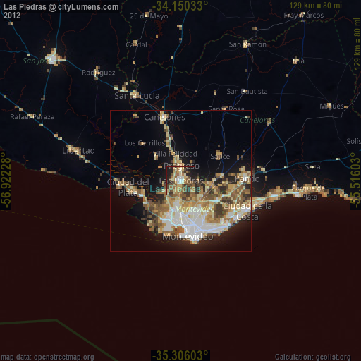
Analysis of Las Piedras night lights 2016
Square area 10x10 km:
 6.59%
6.59%90-99
8.42%80-89
8.06%70-79
7.88%60-69
7.88%50-59
19.96%40-49
18.68%30-39
6.78%20-29
12.45%10-19
3.3%0-9
0%Square area 50x50 km:
5.53%90-99
4.69%80-89
3.07%70-79
3.74%60-69
4.69%50-59
5.62%40-49
3.92%30-39
2.88%20-29
4.77%10-19
10.24%0-9
50.85%Clear (daylight) street map image can be seen on geolist.org.
Map coordinates:
34° 9' 1.2" South, 56° 55' 20.2" West
34° 43' 48.7" South, 56° 13' 8.9" West
35° 18' 21.7" South, 55° 30' 57.7" West
Some cities around Las Piedras sort by population:
• Montevideo
19.5 km =12.1 mi,  171°
171°
• Barros Blancos
19.9 km =12.4 mi,  97°
97°
• La Paz
3.4 km =2.1 mi,  190°
190°
• Delta del Tigre
13.8 km =8.6 mi,  253°
253°
• Progreso
7 km =4.3 mi,  1°
1°
• Colonia Nicolich
20.1 km =12.5 mi,  117°
117°
• Joaquín Suárez
16.9 km =10.5 mi,  91°
91°
• Sauce
16.6 km =10.3 mi,  58°
58°
3442057 (p: 69,682)
Sources (retrieved 2019-11-25):
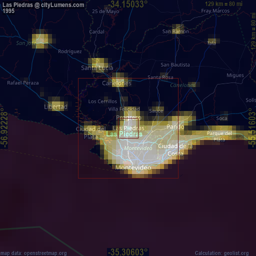
» NASA, Earths city lights 1995
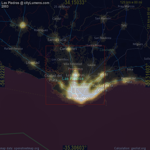
» NASA city lights 2003
» Earth at Night: Flat Maps 2012, 2016