York Beach night lights from space
Night Light of York Beach (Maine) from space (United States) Src. Average luminocity for 10x10km area is 9.1379% and for 50x50km: 7.7857%.
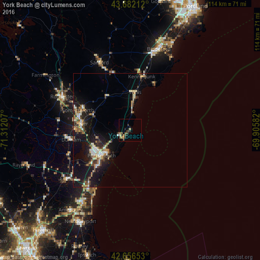
Analysis of York Beach night lights 2016
Square area 10x10 km:
 0.15%
0.15%90-99
0.76%80-89
1.52%70-79
1.21%60-69
1.67%50-59
2.12%40-49
1.67%30-39
1.21%20-29
3.64%10-19
1.21%0-9
84.85%Square area 50x50 km:
0.67%90-99
1.26%80-89
1.15%70-79
0.72%60-69
0.92%50-59
0.89%40-49
1.06%30-39
1.08%20-29
2.4%10-19
7.5%0-9
82.34%Clear (daylight) street map image can be seen on geolist.org.
Map coordinates:
43° 40' 55.6" North, 71° 18' 43.5" West
43° 10' 17.3" North, 70° 36' 32.2" West
42° 39' 23.5" North, 69° 54' 21" West
Some cities around York Beach sort by population:
• Dover
21.7 km =13.5 mi,  277°
277°
• Portsmouth
16 km =9.9 mi,  228°
228°
• Somersworth
23.1 km =14.4 mi,  295°
295°
• Wells Beach Station
17 km =10.6 mi,  4°
4°
• South Berwick
17.7 km =11 mi,  293°
293°
• Eliot
15.6 km =9.7 mi,  262°
262°
• Rye
21.9 km =13.6 mi,  216°
216°
• Kennebunk
24.2 km =15 mi,  12°
12°
4983611 (p: 12,854)
Sources (retrieved 2019-11-25):
» Earth at Night: Flat Maps 2012, 2016