Wells Beach Station night lights from space
Night Light of Wells Beach Station (Maine) from space (United States) Src. Average luminocity for 10x10km area is 12.0924% and for 50x50km: 7.5755%.
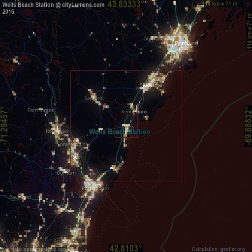
Analysis of Wells Beach Station night lights 2016
Square area 10x10 km:
 0%
0%90-99
0.76%80-89
5.76%70-79
0.91%60-69
0.76%50-59
0.3%40-49
1.06%30-39
0.45%20-29
2.42%10-19
3.18%0-9
84.39%Square area 50x50 km:
0.55%90-99
1.01%80-89
1.21%70-79
0.81%60-69
0.97%50-59
1.02%40-49
1.22%30-39
0.92%20-29
2.25%10-19
5.84%0-9
84.21%Clear (daylight) street map image can be seen on geolist.org.
Map coordinates:
43° 49' 60" North, 71° 17' 40.5" West
43° 19' 26.3" North, 70° 35' 29.2" West
42° 48' 37.1" North, 69° 53' 18" West
Some cities around Wells Beach Station sort by population:
• Biddeford
21.8 km =13.5 mi,  30°
30°
• Sanford
19.6 km =12.2 mi,  310°
310°
• Saco
23 km =14.3 mi, 31°
• York Beach
17 km =10.6 mi,  184°
184°
• Somersworth
23.2 km =14.4 mi,  252°
252°
• South Berwick
20.3 km =12.6 mi,  240°
240°
• Lebanon
22.4 km =13.9 mi,  290°
290°
• Kennebunk
7.7 km =4.8 mi, 29°
4982394 (p: 10,162)
Sources (retrieved 2019-11-25):
» Earth at Night: Flat Maps 2012, 2016