South Berwick night lights from space
Night Light of South Berwick (Maine) from space (United States) Src. Average luminocity for 10x10km area is 12.8591% and for 50x50km: 10.4364%.
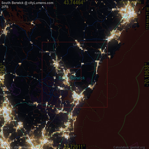
Analysis of South Berwick night lights 2016
Square area 10x10 km:
 0.76%
0.76%90-99
1.21%80-89
1.06%70-79
0.61%60-69
1.82%50-59
1.97%40-49
2.88%30-39
1.52%20-29
6.52%10-19
17.88%0-9
63.79%Square area 50x50 km:
0.86%90-99
1.61%80-89
1.41%70-79
1.06%60-69
1.21%50-59
1.37%40-49
1.66%30-39
1.31%20-29
2.65%10-19
9.08%0-9
77.78%Clear (daylight) street map image can be seen on geolist.org.
Map coordinates:
43° 44' 40.7" North, 71° 30' 45.5" West
43° 14' 4.3" North, 70° 48' 34.2" West
42° 43' 12.4" North, 70° 6' 23" West
Some cities around South Berwick sort by population:
• Dover
6.6 km =4.1 mi,  231°
231°
• Rochester
15.5 km =9.6 mi,  300°
300°
• Portsmouth
18 km =11.2 mi,  166°
166°
• York Beach
17.7 km =11 mi,  113°
113°
• Somersworth
5.4 km =3.4 mi, 303°
• Durham
14.7 km =9.1 mi,  220°
220°
• Eliot
9.1 km =5.7 mi,  175°
175°
• Lebanon
18.1 km =11.2 mi,  349°
349°
4979050 (p: 7,480)
Sources (retrieved 2019-11-25):
» Earth at Night: Flat Maps 2012, 2016