Rye night lights from space
Night Light of Rye (New Hampshire) from space (United States) Src. Average luminocity for 10x10km area is 22.073% and for 50x50km: 12.3936%.
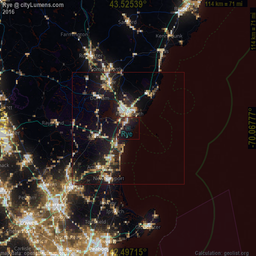
Analysis of Rye night lights 2016
Square area 10x10 km:
 2.38%
2.38%90-99
1.75%80-89
1.11%70-79
2.7%60-69
3.17%50-59
2.38%40-49
4.13%30-39
6.19%20-29
7.46%10-19
35.24%0-9
33.49%Square area 50x50 km:
1.12%90-99
1.74%80-89
1.45%70-79
1.3%60-69
1.56%50-59
1.87%40-49
1.6%30-39
2.12%20-29
4.59%10-19
12.67%0-9
69.99%Clear (daylight) street map image can be seen on geolist.org.
Map coordinates:
43° 31' 31.4" North, 71° 28' 26.5" West
43° 0' 48.3" North, 70° 46' 15.2" West
42° 29' 49.7" North, 70° 4' 4" West
Some cities around Rye sort by population:
• Portsmouth
7.2 km =4.5 mi,  8°
8°
• Durham
18.4 km =11.4 mi,  316°
316°
• Hampton
10.1 km =6.3 mi,  213°
213°
• Exeter
14.8 km =9.2 mi,  256°
256°
• Seabrook
15.5 km =9.6 mi, 211°
• Stratham Station
11 km =6.8 mi,  293°
293°
• Eliot
15.7 km =9.8 mi,  351°
351°
• Newmarket
15.4 km =9.6 mi,  300°
300°
5092018 (p: 5,277)
Sources (retrieved 2019-11-25):
» Earth at Night: Flat Maps 2012, 2016