Wilton night lights from space
Night Light of Wilton (California) from space (United States) Src. Average luminocity for 10x10km area is 11.1396% and for 50x50km: 25.6183%.
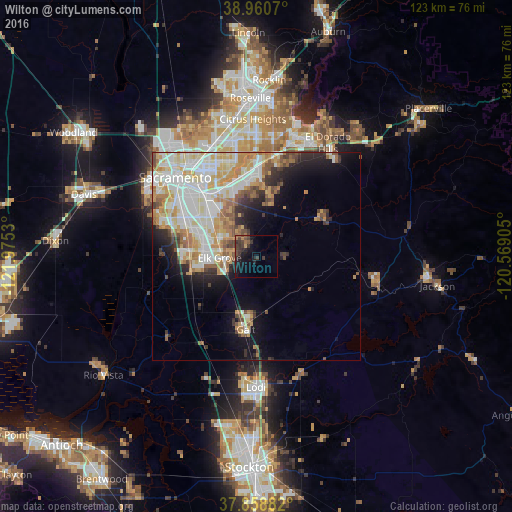
Analysis of Wilton night lights 2016
Square area 10x10 km:
 0%
0%90-99
0%80-89
0%70-79
0.65%60-69
2.44%50-59
1.3%40-49
4.06%30-39
7.31%20-29
3.57%10-19
13.47%0-9
67.21%Square area 50x50 km:
5.78%90-99
6.73%80-89
3.25%70-79
4.23%60-69
3.11%50-59
2.31%40-49
2.04%30-39
2.37%20-29
3.15%10-19
6.72%0-9
60.31%Clear (daylight) street map image can be seen on geolist.org.
Map coordinates:
38° 57' 38.5" North, 121° 58' 31.1" West
38° 24' 42.7" North, 121° 16' 19.8" West
37° 51' 31.8" North, 120° 34' 8.6" West
Some cities around Wilton sort by population:
• Elk Grove
8.7 km =5.4 mi,  267°
267°
• Florin
15.1 km =9.4 mi,  308°
308°
• Laguna
13.3 km =8.3 mi, 274°
• Galt
17.6 km =10.9 mi,  187°
187°
• Vineyard
8.8 km =5.5 mi, 311°
• Rosemont
17.5 km =10.9 mi,  332°
332°
• La Riviera
18.7 km =11.6 mi,  336°
336°
• Rancho Murieta
18.4 km =11.4 mi,  57°
57°
5409941 (p: 5,363)
Sources (retrieved 2019-11-25):
» Earth at Night: Flat Maps 2012, 2016