White City night lights from space
Night Light of White City (Oregon) from space (United States) Src. Average luminocity for 10x10km area is 29.1381% and for 50x50km: 5.8265%.
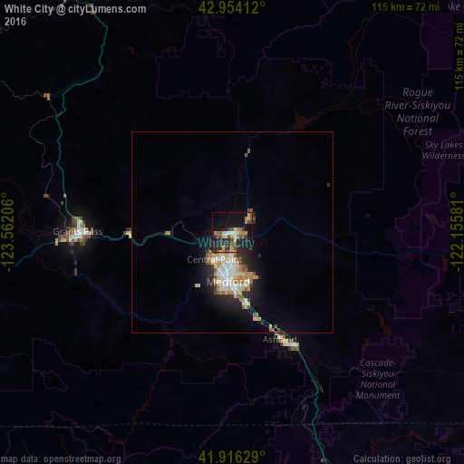
Analysis of White City night lights 2016
Square area 10x10 km:
 1.27%
1.27%90-99
1.59%80-89
5.56%70-79
5.24%60-69
3.65%50-59
4.92%40-49
6.03%30-39
4.76%20-29
14.13%10-19
27.62%0-9
25.24%Square area 50x50 km:
0.79%90-99
0.93%80-89
0.98%70-79
0.78%60-69
0.7%50-59
0.8%40-49
0.6%30-39
0.54%20-29
1.83%10-19
3.66%0-9
88.38%Clear (daylight) street map image can be seen on geolist.org.
Map coordinates:
42° 57' 14.8" North, 123° 33' 43.4" West
42° 26' 14.5" North, 122° 51' 32.1" West
41° 54' 58.6" North, 122° 9' 20.9" West
Some cities around White City sort by population:
• Medford
12.4 km =7.7 mi,  186°
186°
• Grants Pass
38.7 km =24 mi,  270°
270°
• Ashland
29.7 km =18.5 mi,  155°
155°
• Central Point
8.3 km =5.2 mi,  214°
214°
• Eagle Point
6 km =3.7 mi,  49°
49°
• Yreka
80.2 km =49.8 mi,  166°
166°
• Talent
22.1 km =13.7 mi, 164°
• Winston
88.6 km =55.1 mi,  329°
329°
5760396 (p: 7,975)
Sources (retrieved 2019-11-25):
» Earth at Night: Flat Maps 2012, 2016