Medford night lights from space
Night Light of Medford (Oregon) from space (United States) Src. Average luminocity for 10x10km area is 62.5091% and for 50x50km: 6.3389%.
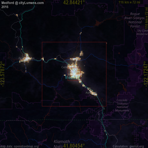
Analysis of Medford night lights 2016
Square area 10x10 km:
 14.7%
14.7%90-99
17.42%80-89
10.91%70-79
5.45%60-69
8.94%50-59
5.45%40-49
3.94%30-39
4.39%20-29
16.06%10-19
10.76%0-9
1.97%Square area 50x50 km:
0.81%90-99
1.02%80-89
1.15%70-79
0.84%60-69
0.72%50-59
0.86%40-49
0.67%30-39
0.64%20-29
1.88%10-19
3.68%0-9
87.74%Clear (daylight) street map image can be seen on geolist.org.
Map coordinates:
42° 50' 39.2" North, 123° 34' 43.4" West
42° 19' 35.5" North, 122° 52' 32.1" West
41° 48' 16.3" North, 122° 10' 20.9" West
Some cities around Medford sort by population:
• Grants Pass
39.4 km =24.5 mi,  288°
288°
• Klamath Falls
90.7 km =56.4 mi,  97°
97°
• Ashland
20.1 km =12.5 mi,  137°
137°
• Central Point
6.4 km =4 mi,  328°
328°
• Eagle Point
17.3 km =10.7 mi,  20°
20°
• White City
12.4 km =7.7 mi,  6°
6°
• Yreka
68.7 km =42.7 mi,  163°
163°
• Talent
11.5 km =7.1 mi, 141°
5740099 (p: 79,805)
Sources (retrieved 2019-11-25):
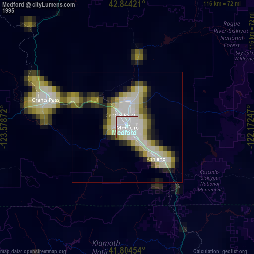
» NASA, Earths city lights 1995
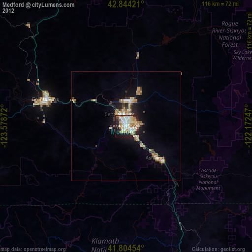
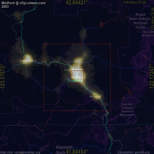
» NASA city lights 2003
» Earth at Night: Flat Maps 2012, 2016