Grants Pass night lights from space
Night Light of Grants Pass (Oregon) from space (United States) Src. Average luminocity for 10x10km area is 30.673% and for 50x50km: 1.6188%.
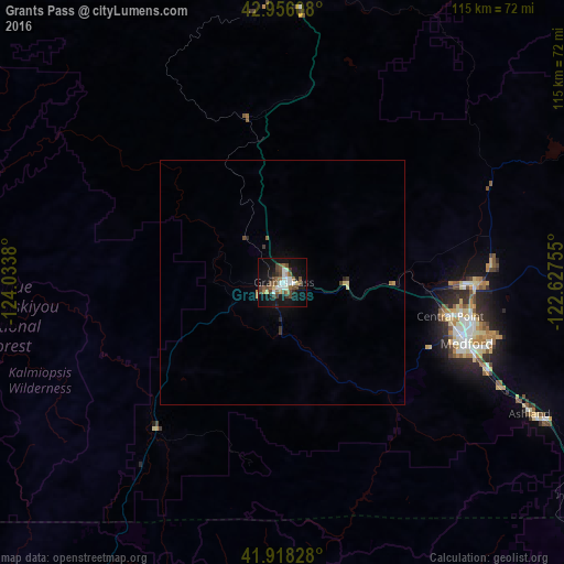

Analysis of Grants Pass night lights 2016
Square area 10x10 km:
 4.6%
4.6%90-99
4.92%80-89
2.38%70-79
1.27%60-69
3.81%50-59
6.83%40-49
9.37%30-39
3.97%20-29
2.38%10-19
31.59%0-9
28.89%Square area 50x50 km:
0.19%90-99
0.2%80-89
0.16%70-79
0.12%60-69
0.18%50-59
0.3%40-49
0.4%30-39
0.29%20-29
0.19%10-19
1.4%0-9
96.58%Clear (daylight) street map image can be seen on geolist.org.
Map coordinates:
42° 57' 21.9" North, 124° 2' 1.7" West
42° 26' 21.6" North, 123° 19' 50.4" West
41° 55' 5.8" North, 122° 37' 39.2" West
Some cities around Grants Pass sort by population:
• Medford
39.4 km =24.5 mi,  108°
108°
• Ashland
57.9 km =36 mi,  118°
118°
• Central Point
34.7 km =21.6 mi,  101°
101°
• Eagle Point
43.5 km =27 mi,  85°
85°
• White City
38.7 km =24 mi, 90°
• Green
80.2 km =49.8 mi,  357°
357°
• Talent
49.5 km =30.8 mi, 115°
• Winston
76.2 km =47.3 mi,  354°
354°
5729080 (p: 37,088)
Sources (retrieved 2019-11-25):
» Earth at Night: Flat Maps 2012, 2016