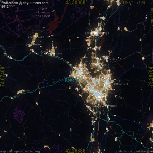
Rotterdam night lights from space
Night Light of Rotterdam (New York) from space (United States) Src. Average luminocity for 10x10km area is 55.7212% and for 50x50km: 23.4018%.
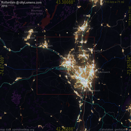
Analysis of Rotterdam night lights 2016
Square area 10x10 km:
 10.76%
90-99
14.24%80-89
5.45%70-79
8.94%60-69
10.76%50-59
5.76%40-49
7.27%30-39
3.03%20-29
11.52%10-19
16.52%0-9
5.76%Square area 50x50 km:
3.64%90-99
4.1%80-89
2.68%70-79
3.19%60-69
3.27%50-59
3.86%40-49
4.29%30-39
3.79%20-29
6.19%10-19
11.14%0-9
53.87%Clear (daylight) street map image can be seen on geolist.org.
Map coordinates:
43° 18' 3.2" North, 74° 40' 26.7" West
42° 47' 13.3" North, 73° 58' 15.5" West
42° 16' 7.9" North, 73° 16' 4.2" West
Some cities around Rotterdam sort by population:
• West Albany
19.5 km =12.1 mi,  126°
126°
• Schenectady
4 km =2.5 mi,  40°
40°
• Latham
17.9 km =11.1 mi,  104°
104°
• Roessleville
16.8 km =10.4 mi, 127°
• Colonie
13.6 km =8.5 mi,  124°
124°
• Scotia
4.4 km =2.7 mi,  7°
7°
• Westmere
13.5 km =8.4 mi,  141°
141°
• East Glenville
12.5 km =7.8 mi,  16°
16°
5134453 (p: 20,652)
Sources (retrieved 2019-11-25):
» Earth at Night: Flat Maps 2012, 2016