Westford night lights from space
Night Light of Westford (Massachusetts) from space (United States) Src. Average luminocity for 10x10km area is 32.9714% and for 50x50km: 37.4191%.
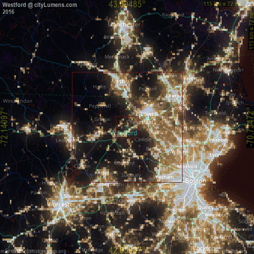
Analysis of Westford night lights 2016
Square area 10x10 km:
 0.63%
0.63%90-99
1.75%80-89
4.44%70-79
4.13%60-69
6.03%50-59
5.56%40-49
8.25%30-39
11.11%20-29
14.44%10-19
36.83%0-9
6.83%Square area 50x50 km:
4.98%90-99
6.37%80-89
4.39%70-79
4.55%60-69
6.68%50-59
8.47%40-49
5.83%30-39
5.1%20-29
8.7%10-19
21.13%0-9
23.82%Clear (daylight) street map image can be seen on geolist.org.
Map coordinates:
43° 5' 41.5" North, 72° 8' 27.5" West
42° 34' 45.3" North, 71° 26' 16.2" West
42° 3' 33.7" North, 70° 44' 5" West
Some cities around Westford sort by population:
• Lowell
11.6 km =7.2 mi,  58°
58°
• Billerica
14 km =8.7 mi,  99°
99°
• Chelmsford
6.2 km =3.9 mi,  68°
68°
• Dracut
15 km =9.3 mi,  47°
47°
• Acton
10.5 km =6.5 mi,  177°
177°
• Tyngsboro
10.9 km =6.8 mi,  5°
5°
• Harvard
14.8 km =9.2 mi,  233°
233°
• West Concord
13.9 km =8.6 mi,  165°
165°
4955219 (p: 21,587)
Sources (retrieved 2019-11-25):
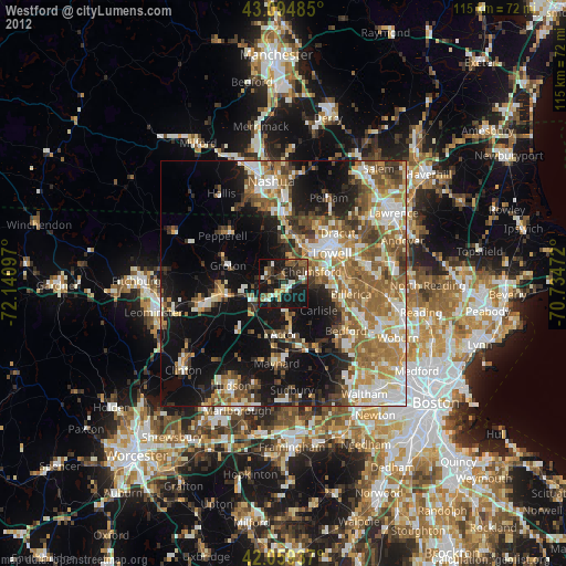
» Earth at Night: Flat Maps 2012, 2016