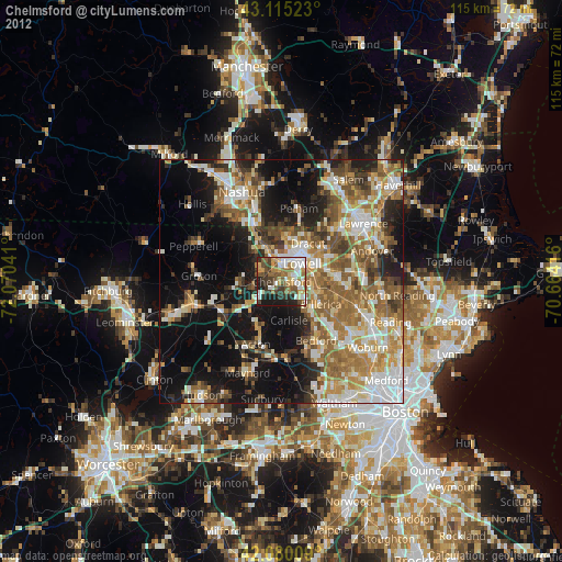
Chelmsford night lights from space
Night Light of Chelmsford (Massachusetts) from space (United States) Src. Average luminocity for 10x10km area is 59.2803% and for 50x50km: 42.0897%.
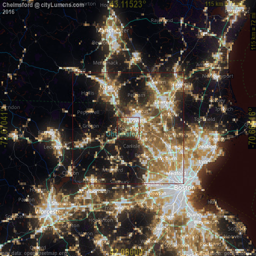
Analysis of Chelmsford night lights 2016
Square area 10x10 km:
 11.36%
90-99
11.52%80-89
6.82%70-79
6.67%60-69
11.21%50-59
9.39%40-49
10.76%30-39
15.15%20-29
12.42%10-19
4.7%0-9
0%Square area 50x50 km:
6.16%90-99
7.27%80-89
4.92%70-79
5.67%60-69
7.76%50-59
9.19%40-49
6.28%30-39
5.66%20-29
9.44%10-19
19.29%0-9
18.37%Clear (daylight) street map image can be seen on geolist.org.
Map coordinates:
43° 6' 54.8" North, 72° 4' 13.5" West
42° 35' 59.3" North, 71° 22' 2.2" West
42° 4' 48.3" North, 70° 39' 51" West
Some cities around Chelmsford sort by population:
• Lowell
5.6 km =3.5 mi,  48°
48°
• Billerica
9.3 km =5.8 mi,  119°
119°
• Tewksbury
11 km =6.8 mi,  83°
83°
• Dracut
9.5 km =5.9 mi,  34°
34°
• Westford
6.2 km =3.9 mi,  248°
248°
• Acton
13.8 km =8.6 mi,  202°
202°
• Tyngsboro
9.8 km =6.1 mi,  331°
331°
• Pinehurst
13.8 km =8.6 mi, 124°
4932869 (p: 33,925)
Sources (retrieved 2019-11-25):
» Earth at Night: Flat Maps 2012, 2016