McCordsville night lights from space
Night Light of McCordsville (Indiana) from space (United States) Src. Average luminocity for 10x10km area is 56.1616% and for 50x50km: 46.6695%.
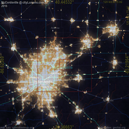
Analysis of McCordsville night lights 2016
Square area 10x10 km:
 3.74%
3.74%90-99
6.12%80-89
8.33%70-79
15.82%60-69
20.58%50-59
9.69%40-49
5.61%30-39
5.95%20-29
10.88%10-19
11.9%0-9
1.36%Square area 50x50 km:
11.79%90-99
10.65%80-89
6.89%70-79
8.54%60-69
5.95%50-59
4.27%40-49
3.43%30-39
3.2%20-29
5.05%10-19
11.43%0-9
28.8%Clear (daylight) street map image can be seen on geolist.org.
Map coordinates:
40° 26' 43.2" North, 86° 37' 33.2" West
39° 54' 29.2" North, 85° 55' 21.9" West
39° 21' 59.9" North, 85° 13' 10.7" West
Some cities around McCordsville sort by population:
• Carmel
18.4 km =11.4 mi,  295°
295°
• Fishers
9.4 km =5.8 mi, 304°
• Noblesville
16.9 km =10.5 mi,  334°
334°
• Lawrence
11.7 km =7.3 mi,  228°
228°
• Westfield
23 km =14.3 mi,  310°
310°
• Greenfield
18.9 km =11.7 mi,  136°
136°
• Broad Ripple
19.2 km =11.9 mi,  256°
256°
• Cumberland
15 km =9.3 mi,  191°
191°
4261132 (p: 5,773)
Sources (retrieved 2019-11-25):
» Earth at Night: Flat Maps 2012, 2016