Pontiac night lights from space
Night Light of Pontiac (Michigan) from space (United States) Src. Average luminocity for 10x10km area is 87.797% and for 50x50km: 56.08%.
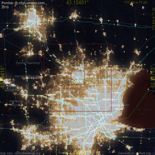
Analysis of Pontiac night lights 2016
Square area 10x10 km:
 28.94%
90-99
30.3%80-89
10.61%70-79
13.79%60-69
11.67%50-59
4.55%40-49
0.15%30-39
0%20-29
0%10-19
0%0-9
0%Square area 50x50 km:
14.79%90-99
11.69%80-89
5.4%70-79
7.69%60-69
11.55%50-59
8.99%40-49
6.3%30-39
4.83%20-29
5.23%10-19
7.23%0-9
16.31%Clear (daylight) street map image can be seen on geolist.org.
Map coordinates:
43° 9' 14.4" North, 83° 59' 39" West
42° 38' 20.1" North, 83° 17' 27.8" West
42° 7' 10.3" North, 82° 35' 16.5" West
Some cities around Pontiac sort by population:
• Troy
12.1 km =7.5 mi,  107°
107°
• Waterford
11.6 km =7.2 mi,  301°
301°
• Rochester Hills
11.7 km =7.3 mi,  79°
79°
• West Bloomfield Township
10.9 km =6.8 mi,  224°
224°
• Auburn Hills
7.1 km =4.4 mi,  40°
40°
• Birmingham
12.2 km =7.6 mi,  147°
147°
• Rochester
13.7 km =8.5 mi,  70°
70°
• Beverly Hills
13.9 km =8.6 mi,  156°
156°
5006166 (p: 59,917)
Sources (retrieved 2019-11-25):
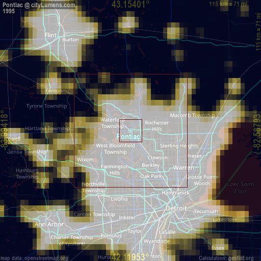
» NASA, Earths city lights 1995
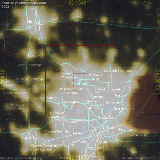
» NASA city lights 2003
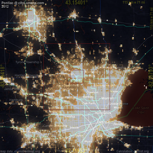
» Earth at Night: Flat Maps 2012, 2016