Weslaco night lights from space
Night Light of Weslaco (Texas) from space (United States) Src. Average luminocity for 10x10km area is 76.3948% and for 50x50km: 41.8639%.
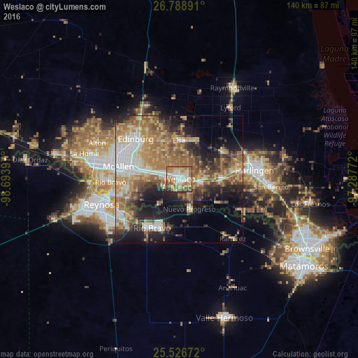
Analysis of Weslaco night lights 2016
Square area 10x10 km:
 13.29%
90-99
17.86%80-89
16.47%70-79
13.29%60-69
21.63%50-59
7.74%40-49
7.14%30-39
1.39%20-29
1.19%10-19
0%0-9
0%Square area 50x50 km:
6.16%90-99
5.51%80-89
7.59%70-79
6.44%60-69
9.77%50-59
7.85%40-49
5.61%30-39
5.28%20-29
7.64%10-19
11.95%0-9
26.2%Clear (daylight) street map image can be seen on geolist.org.
Map coordinates:
26° 47' 20.1" North, 98° 41' 38.3" West
26° 9' 34.3" North, 97° 59' 27" West
25° 31' 36.2" North, 97° 17' 15.8" West
Some cities around Weslaco sort by population:
• Alamo
13.5 km =8.4 mi,  281°
281°
• Mercedes
7.8 km =4.8 mi,  97°
97°
• Donna
6.2 km =3.9 mi, 281°
• Nuevo Progreso, MX
12.2 km =7.6 mi,  161°
161°
• Murillo Colonia
16.3 km =10.1 mi,  311°
311°
• Elsa
14.9 km =9.3 mi,  359°
359°
• Mila Doce
8.1 km =5 mi,  23°
23°
• Progreso
8.2 km =5.1 mi, 155°
4740629 (p: 39,474)
Sources (retrieved 2019-11-25):
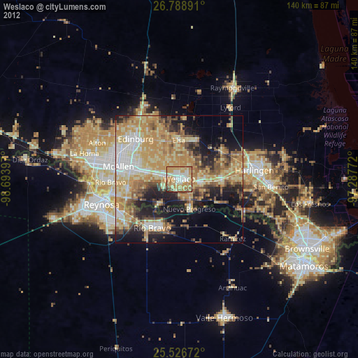
» Earth at Night: Flat Maps 2012, 2016