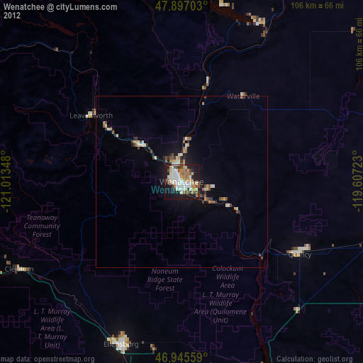
Wenatchee night lights from space
Night Light of Wenatchee (Washington) from space (United States) Src. Average luminocity for 10x10km area is 52.4432% and for 50x50km: 4.0867%.
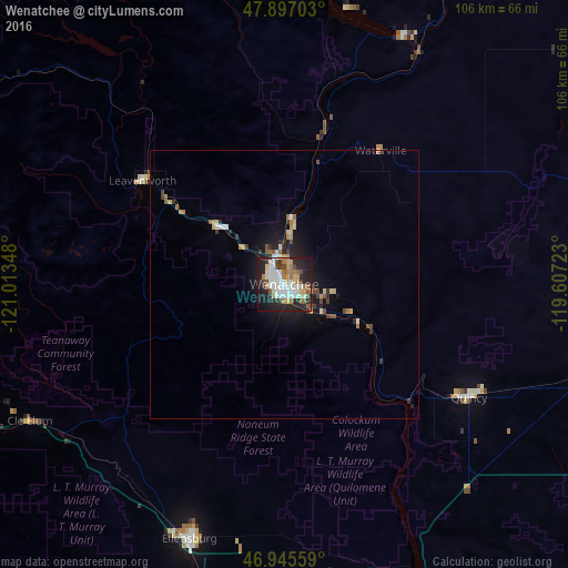
Analysis of Wenatchee night lights 2016
Square area 10x10 km:
 12.93%
90-99
13.64%80-89
4.4%70-79
5.26%60-69
7.24%50-59
5.26%40-49
4.12%30-39
3.98%20-29
19.89%10-19
20.88%0-9
2.41%Square area 50x50 km:
0.65%90-99
0.67%80-89
0.43%70-79
0.45%60-69
0.54%50-59
0.38%40-49
0.53%30-39
0.55%20-29
1.22%10-19
2.89%0-9
91.71%Clear (daylight) street map image can be seen on geolist.org.
Map coordinates:
47° 53' 49.3" North, 121° 0' 48.5" West
47° 25' 24.5" North, 120° 18' 37.3" West
46° 56' 44.1" North, 119° 36' 26" West
Some cities around Wenatchee sort by population:
• Moses Lake
84.4 km =52.4 mi,  112°
112°
• Ellensburg
50.7 km =31.5 mi,  200°
200°
• East Wenatchee
1.6 km =1 mi,  123°
123°
• East Wenatchee Bench
2.2 km =1.4 mi,  83°
83°
• Ephrata
58.2 km =36.2 mi,  101°
101°
• Selah
87.2 km =54.2 mi,  191°
191°
• Quincy
40.4 km =25.1 mi, 121°
• Terrace Heights
91.4 km =56.8 mi, 186°
5815342 (p: 33,636)
Sources (retrieved 2019-11-25):
» Earth at Night: Flat Maps 2012, 2016