Quincy night lights from space
Night Light of Quincy (Washington) from space (United States) Src. Average luminocity for 10x10km area is 14.0253% and for 50x50km: 1.3569%.
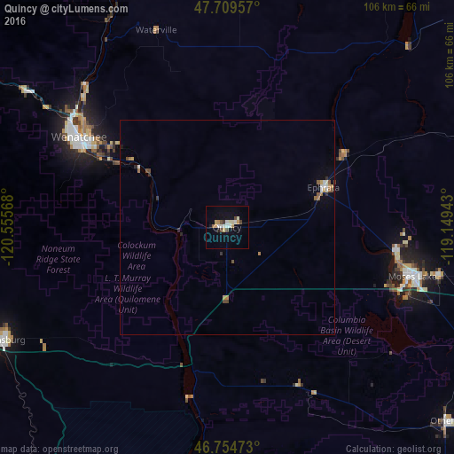
Analysis of Quincy night lights 2016
Square area 10x10 km:
 1.93%
1.93%90-99
3.27%80-89
1.34%70-79
2.53%60-69
0.6%50-59
0.6%40-49
2.83%30-39
0.6%20-29
0.6%10-19
4.32%0-9
81.4%Square area 50x50 km:
0.18%90-99
0.21%80-89
0.09%70-79
0.22%60-69
0.17%50-59
0.16%40-49
0.25%30-39
0.13%20-29
0.11%10-19
0.25%0-9
98.22%Clear (daylight) street map image can be seen on geolist.org.
Map coordinates:
47° 42' 34.5" North, 120° 33' 20.4" West
47° 14' 3.5" North, 119° 51' 9.2" West
46° 45' 17" North, 119° 8' 57.9" West
Some cities around Quincy sort by population:
• Wenatchee
40.4 km =25.1 mi,  301°
301°
• Moses Lake
44.9 km =27.9 mi,  104°
104°
• Ellensburg
58.9 km =36.6 mi,  243°
243°
• East Wenatchee
38.9 km =24.2 mi, 301°
• East Wenatchee Bench
38.7 km =24 mi, 303°
• Ephrata
24.4 km =15.2 mi,  67°
67°
• Othello
68.5 km =42.6 mi,  131°
131°
• Selah
82.5 km =51.3 mi,  218°
218°
5807713 (p: 7,365)
Sources (retrieved 2019-11-25):
» Earth at Night: Flat Maps 2012, 2016