Lebanon night lights from space
Night Light of Lebanon (Maine) from space (United States) Src. Average luminocity for 10x10km area is 0.546% and for 50x50km: 5.5945%.
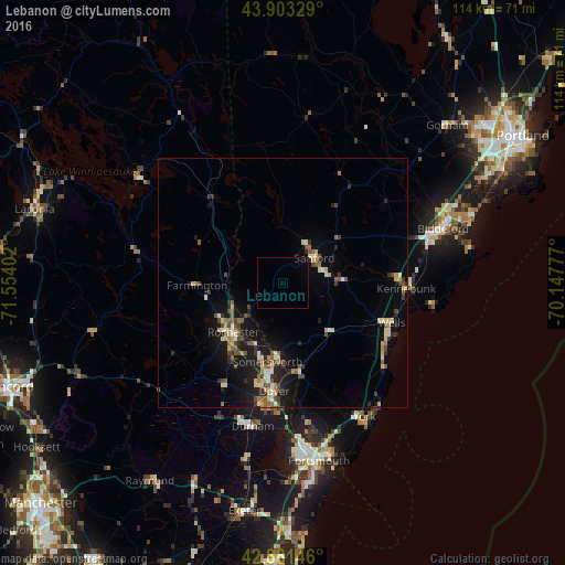
Analysis of Lebanon night lights 2016
Square area 10x10 km:
 0%
0%90-99
0%80-89
0%70-79
0%60-69
0%50-59
0%40-49
0%30-39
0%20-29
0%10-19
0%0-9
100%Square area 50x50 km:
0.27%90-99
0.79%80-89
0.88%70-79
0.63%60-69
0.64%50-59
0.86%40-49
1.04%30-39
0.6%20-29
1.32%10-19
4.55%0-9
88.43%Clear (daylight) street map image can be seen on geolist.org.
Map coordinates:
43° 54' 11.8" North, 71° 33' 14.5" West
43° 23' 40.3" North, 70° 51' 3.2" West
42° 52' 53.3" North, 70° 8' 52" West
Some cities around Lebanon sort by population:
• Dover
21.9 km =13.6 mi,  184°
184°
• Rochester
14.2 km =8.8 mi,  225°
225°
• Sanford
7.9 km =4.9 mi,  51°
51°
• Somersworth
14.8 km =9.2 mi, 184°
• Wells Beach Station
22.4 km =13.9 mi,  110°
110°
• Waterboro
19.1 km =11.9 mi,  34°
34°
• South Berwick
18.1 km =11.2 mi,  169°
169°
• Kennebunk
24.8 km =15.4 mi,  92°
92°
4969280 (p: 5,446)
Sources (retrieved 2019-11-25):
» Earth at Night: Flat Maps 2012, 2016