Boone night lights from space
Night Light of Boone (Iowa) from space (United States) Src. Average luminocity for 10x10km area is 21.7333% and for 50x50km: 5.3584%.
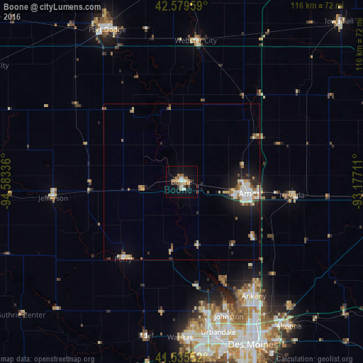
Analysis of Boone night lights 2016
Square area 10x10 km:
 2.86%
2.86%90-99
2.86%80-89
1.27%70-79
2.38%60-69
5.56%50-59
3.97%40-49
2.06%30-39
1.9%20-29
3.17%10-19
17.3%0-9
56.67%Square area 50x50 km:
0.82%90-99
0.9%80-89
0.74%70-79
0.46%60-69
0.92%50-59
0.53%40-49
0.64%30-39
0.43%20-29
1.41%10-19
3.03%0-9
90.11%Clear (daylight) street map image can be seen on geolist.org.
Map coordinates:
42° 34' 46.5" North, 94° 35' 0.1" West
42° 3' 34.9" North, 93° 52' 48.8" West
41° 32' 7.9" North, 93° 10' 37.6" West
Some cities around Boone sort by population:
• Ames
21.7 km =13.5 mi,  97°
97°
• Ankeny
43.2 km =26.8 mi,  148°
148°
• Johnston
45.6 km =28.3 mi,  160°
160°
• Grimes
41.9 km =26 mi,  169°
169°
• Perry
30.9 km =19.2 mi,  217°
217°
• Webster City
45.9 km =28.5 mi,  6°
6°
• Nevada
35.6 km =22.1 mi, 96°
• Centerville
5.9 km =3.7 mi,  308°
308°
4849051 (p: 12,692)
Sources (retrieved 2019-11-25):
» Earth at Night: Flat Maps 2012, 2016