River Oaks night lights from space
Night Light of River Oaks (Texas) from space (United States) Src. Average luminocity for 10x10km area is 90.9353% and for 50x50km: 62.6023%.
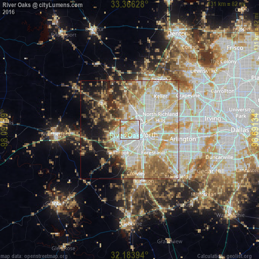
Analysis of River Oaks night lights 2016
Square area 10x10 km:
 33.57%
90-99
28.15%80-89
19.93%70-79
13.11%60-69
5.24%50-59
0%40-49
0%30-39
0%20-29
0%10-19
0%0-9
0%Square area 50x50 km:
14.79%90-99
15.7%80-89
11.93%70-79
8.85%60-69
8.66%50-59
6.79%40-49
4.57%30-39
4.24%20-29
6.21%10-19
8.95%0-9
9.31%Clear (daylight) street map image can be seen on geolist.org.
Map coordinates:
33° 21' 58.6" North, 98° 5' 51.3" West
32° 46' 37.5" North, 97° 23' 40.1" West
32° 11' 2.2" North, 96° 41' 28.8" West
Some cities around River Oaks sort by population:
• Fort Worth
9 km =5.6 mi,  129°
129°
• Haltom City
12 km =7.5 mi,  77°
77°
• Watauga
15.9 km =9.9 mi,  55°
55°
• Benbrook
13.1 km =8.1 mi,  208°
208°
• Saginaw
9.7 km =6 mi,  17°
17°
• White Settlement
6.3 km =3.9 mi,  251°
251°
• Richland Hills
16.1 km =10 mi,  74°
74°
• Eagle Mountain
13.8 km =8.6 mi,  340°
340°
4722925 (p: 7,724)
Sources (retrieved 2019-11-25):
» Earth at Night: Flat Maps 2012, 2016