Washington night lights from space
Night Light of Washington (Utah) from space (United States) Src. Average luminocity for 10x10km area is 45.5935% and for 50x50km: 7.8212%.
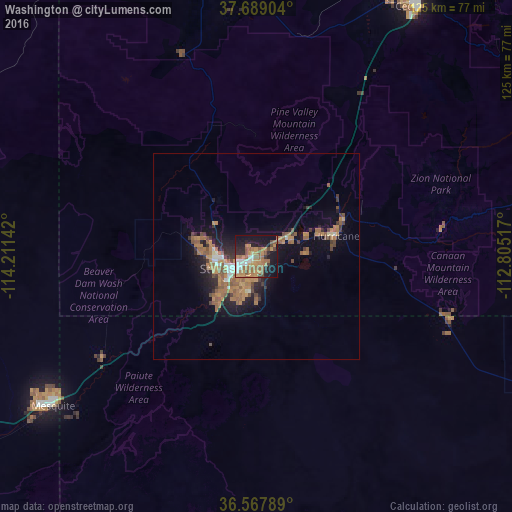
Analysis of Washington night lights 2016
Square area 10x10 km:
 6.63%
6.63%90-99
3.74%80-89
2.21%70-79
11.56%60-69
15.48%50-59
10.37%40-49
3.57%30-39
3.23%20-29
9.69%10-19
31.46%0-9
2.04%Square area 50x50 km:
0.54%90-99
0.6%80-89
0.24%70-79
1.74%60-69
2.32%50-59
1.98%40-49
1.03%30-39
0.97%20-29
1.82%10-19
4.94%0-9
83.82%Clear (daylight) street map image can be seen on geolist.org.
Map coordinates:
37° 41' 20.5" North, 114° 12' 41.1" West
37° 7' 49.9" North, 113° 30' 29.8" West
36° 34' 4.4" North, 112° 48' 18.6" West
Some cities around Washington sort by population:
• Saint George
7.3 km =4.5 mi,  246°
246°
• Cedar City
72.5 km =45 mi,  32°
32°
• Mesquite
61.4 km =38.2 mi,  233°
233°
• Hurricane
20 km =12.4 mi,  75°
75°
• Ivins
15.7 km =9.8 mi,  285°
285°
• Moapa Valley
105.2 km =65.4 mi, 234°
• Santa Clara
12.9 km =8 mi,  271°
271°
• Enoch
83.3 km =51.8 mi, 30°
5549222 (p: 24,299)
Sources (retrieved 2019-11-25):
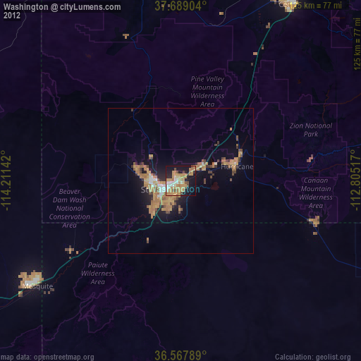
» Earth at Night: Flat Maps 2012, 2016