Santa Clara night lights from space
Night Light of Santa Clara (Utah) from space (United States) Src. Average luminocity for 10x10km area is 35.3214% and for 50x50km: 6.8586%.
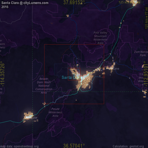
Analysis of Santa Clara night lights 2016
Square area 10x10 km:
 1.87%
1.87%90-99
4.93%80-89
0.85%70-79
7.82%60-69
12.76%50-59
8.5%40-49
4.08%30-39
3.91%20-29
8.67%10-19
20.58%0-9
26.02%Square area 50x50 km:
0.52%90-99
0.59%80-89
0.19%70-79
1.57%60-69
2.08%50-59
1.79%40-49
0.76%30-39
0.74%20-29
1.71%10-19
4.55%0-9
85.51%Clear (daylight) street map image can be seen on geolist.org.
Map coordinates:
37° 41' 29.5" North, 114° 21' 26.1" West
37° 7' 58.9" North, 113° 39' 14.9" West
36° 34' 13.5" North, 112° 57' 3.6" West
Some cities around Santa Clara sort by population:
• Saint George
7 km =4.3 mi,  117°
117°
• Cedar City
80 km =49.7 mi,  40°
40°
• Washington
12.9 km =8 mi,  91°
91°
• Mesquite
51.7 km =32.1 mi,  225°
225°
• Hurricane
32.6 km =20.3 mi,  81°
81°
• Ivins
4.5 km =2.8 mi,  330°
330°
• Moapa Valley
95.1 km =59.1 mi, 229°
• Enoch
90.3 km =56.1 mi, 37°
5546441 (p: 6,841)
Sources (retrieved 2019-11-25):
» Earth at Night: Flat Maps 2012, 2016