Wasco night lights from space
Night Light of Wasco (California) from space (United States) Src. Average luminocity for 10x10km area is 16.3636% and for 50x50km: 8.6302%.
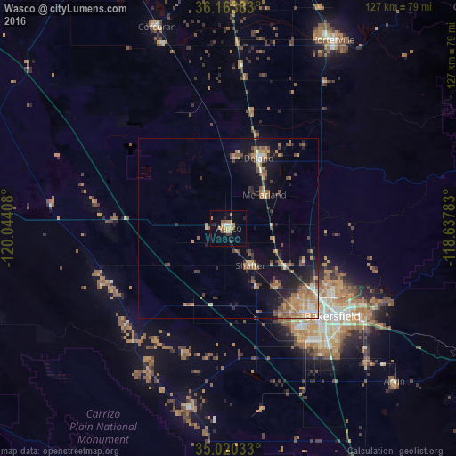
Analysis of Wasco night lights 2016
Square area 10x10 km:
 0.7%
0.7%90-99
0.7%80-89
2.8%70-79
4.02%60-69
3.32%50-59
2.62%40-49
0.7%30-39
1.22%20-29
2.45%10-19
4.9%0-9
76.57%Square area 50x50 km:
0.51%90-99
0.69%80-89
0.63%70-79
1.74%60-69
2.08%50-59
1.52%40-49
1.61%30-39
1.28%20-29
1.49%10-19
6.45%0-9
81.99%Clear (daylight) street map image can be seen on geolist.org.
Map coordinates:
36° 9' 49.8" North, 120° 2' 38.7" West
35° 35' 38.8" North, 119° 20' 27.4" West
35° 1' 13.2" North, 118° 38' 16.2" West
Some cities around Wasco sort by population:
• Bakersfield
38.1 km =23.7 mi,  130°
130°
• Delano
21.2 km =13.2 mi,  23°
23°
• Oildale
35 km =21.7 mi,  123°
123°
• Shafter
12.1 km =7.5 mi,  148°
148°
• Rosedale
29.4 km =18.3 mi,  142°
142°
• McFarland
13.7 km =8.5 mi,  47°
47°
• Earlimart
32.8 km =20.4 mi,  10°
10°
• Greenacres
31.4 km =19.5 mi, 138°
5550368 (p: 26,279)
Sources (retrieved 2019-11-25):
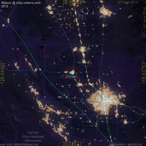
» Earth at Night: Flat Maps 2012, 2016