Catoosa night lights from space
Night Light of Catoosa (Oklahoma) from space (United States) Src. Average luminocity for 10x10km area is 49.8759% and for 50x50km: 39.2942%.
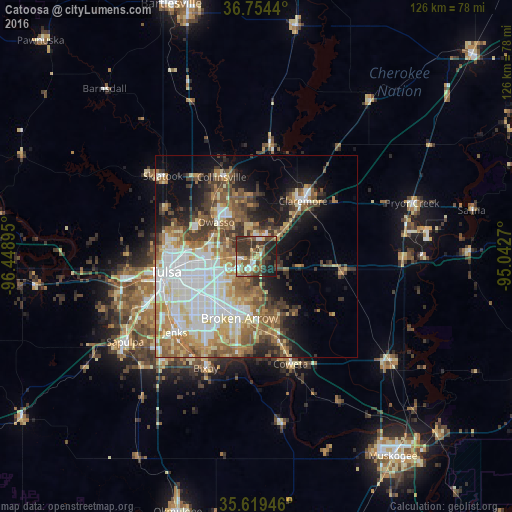
Analysis of Catoosa night lights 2016
Square area 10x10 km:
 5.24%
5.24%90-99
7.34%80-89
8.22%70-79
3.5%60-69
5.42%50-59
13.81%40-49
9.79%30-39
22.03%20-29
14.16%10-19
10.49%0-9
0%Square area 50x50 km:
8.17%90-99
8.37%80-89
5.43%70-79
4.77%60-69
6.12%50-59
6.66%40-49
4.36%30-39
6%20-29
4.39%10-19
9.74%0-9
35.98%Clear (daylight) street map image can be seen on geolist.org.
Map coordinates:
36° 45' 15.8" North, 96° 26' 56.2" West
36° 11' 20.4" North, 95° 44' 45" West
35° 37' 10.1" North, 95° 2' 33.7" West
Some cities around Catoosa sort by population:
• Tulsa
22.5 km =14 mi,  260°
260°
• Broken Arrow
15.7 km =9.8 mi,  194°
194°
• Owasso
13.3 km =8.3 mi,  312°
312°
• Bixby
30.1 km =18.7 mi,  204°
204°
• Jenks
27.2 km =16.9 mi,  227°
227°
• Claremore
18 km =11.2 mi,  40°
40°
• Coweta
27.7 km =17.2 mi,  162°
162°
• Collinsville
21.2 km =13.2 mi,  336°
336°
4532493 (p: 7,146)
Sources (retrieved 2019-11-25):
» Earth at Night: Flat Maps 2012, 2016