South Venice night lights from space
Night Light of South Venice (Florida) from space (United States) Src. Average luminocity for 10x10km area is 50.8175% and for 50x50km: 18.5869%.
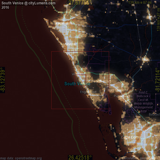
Analysis of South Venice night lights 2016
Square area 10x10 km:
 6.15%
6.15%90-99
11.11%80-89
4.17%70-79
8.93%60-69
19.84%50-59
4.76%40-49
3.97%30-39
2.38%20-29
13.69%10-19
16.67%0-9
8.33%Square area 50x50 km:
1.37%90-99
2%80-89
1.26%70-79
1.77%60-69
7.48%50-59
4.07%40-49
2.57%30-39
3.1%20-29
6.84%10-19
10.5%0-9
59.05%Clear (daylight) street map image can be seen on geolist.org.
Map coordinates:
27° 40' 39.2" North, 83° 7' 38.6" West
27° 3' 11.2" North, 82° 25' 27.3" West
26° 25' 30.6" North, 81° 43' 16.1" West
Some cities around South Venice sort by population:
• North Port
18.7 km =11.6 mi,  93°
93°
• Venice
6 km =3.7 mi,  330°
330°
• Englewood
12.4 km =7.7 mi,  144°
144°
• Rotonda West
23.1 km =14.4 mi, 144°
• Laurel
10.7 km =6.6 mi,  339°
339°
• Venice Gardens
2.8 km =1.7 mi,  36°
36°
• Osprey
17.2 km =10.7 mi, 337°
• Warm Mineral Springs
16.3 km =10.1 mi, 87°
4173593 (p: 13,949)
Sources (retrieved 2019-11-25):
» Earth at Night: Flat Maps 2012, 2016