Osprey night lights from space
Night Light of Osprey (Florida) from space (United States) Src. Average luminocity for 10x10km area is 44.8636% and for 50x50km: 23.4907%.
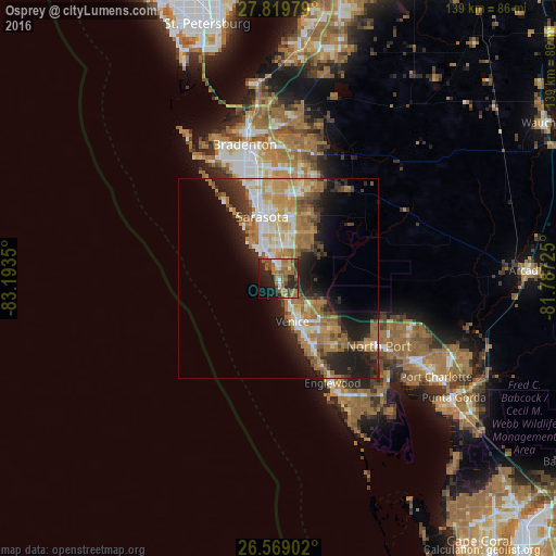
Analysis of Osprey night lights 2016
Square area 10x10 km:
 3.41%
3.41%90-99
4.55%80-89
2.84%70-79
3.22%60-69
23.48%50-59
8.9%40-49
6.25%30-39
5.68%20-29
19.7%10-19
15.15%0-9
6.82%Square area 50x50 km:
2.87%90-99
3.61%80-89
2.5%70-79
4.17%60-69
7.26%50-59
3.11%40-49
2.26%30-39
3%20-29
6.6%10-19
9.72%0-9
54.91%Clear (daylight) street map image can be seen on geolist.org.
Map coordinates:
27° 49' 11.2" North, 83° 11' 36.6" West
27° 11' 46.2" North, 82° 29' 25.3" West
26° 34' 8.5" North, 81° 47' 14.1" West
Some cities around Osprey sort by population:
• Venice
11.3 km =7 mi,  161°
161°
• Sarasota Springs
12.6 km =7.8 mi,  4°
4°
• Gulf Gate Estates
6.6 km =4.1 mi,  338°
338°
• Bee Ridge
9.8 km =6.1 mi,  5°
5°
• Laurel
6.5 km =4 mi,  153°
153°
• Southgate
12.6 km =7.8 mi,  351°
351°
• Siesta Key
9.6 km =6 mi,  325°
325°
• South Gate Ridge
10.1 km =6.3 mi,  356°
356°
4167245 (p: 6,100)
Sources (retrieved 2019-11-25):
» Earth at Night: Flat Maps 2012, 2016