Northdale night lights from space
Night Light of Northdale (Florida) from space (United States) Src. Average luminocity for 10x10km area is 86.4792% and for 50x50km: 70.2046%.
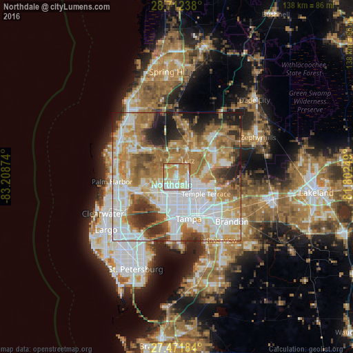

Analysis of Northdale night lights 2016
Square area 10x10 km:
 17.61%
90-99
29.17%80-89
17.8%70-79
27.84%60-69
7.58%50-59
0%40-49
0%30-39
0%20-29
0%10-19
0%0-9
0%Square area 50x50 km:
19.83%90-99
14.99%80-89
7.7%70-79
10.8%60-69
17.14%50-59
6.63%40-49
5.28%30-39
4.85%20-29
7.02%10-19
5.34%0-9
0.4%Clear (daylight) street map image can be seen on geolist.org.
Map coordinates:
28° 42' 44.6" North, 83° 12' 31.5" West
28° 5' 38" North, 82° 30' 20.2" West
27° 28' 18.6" North, 81° 48' 9" West
Some cities around Northdale sort by population:
• University
6.9 km =4.3 mi,  108°
108°
• Carrollwood Village
3.3 km =2.1 mi,  207°
207°
• Carrollwood
5 km =3.1 mi,  165°
165°
• Lake Magdalene
4 km =2.5 mi,  123°
123°
• Citrus Park
6.5 km =4 mi,  254°
254°
• Greater Northdale
2.4 km =1.5 mi,  302°
302°
• Lutz
7.7 km =4.8 mi,  34°
34°
• Cheval
6.1 km =3.8 mi,  351°
351°
8479411 (p: 22,079)
Sources (retrieved 2019-11-25):
» Earth at Night: Flat Maps 2012, 2016