Desert Hot Springs night lights from space
Night Light of Desert Hot Springs (California) from space (United States) Src. Average luminocity for 10x10km area is 32.9441% and for 50x50km: 13.4738%.
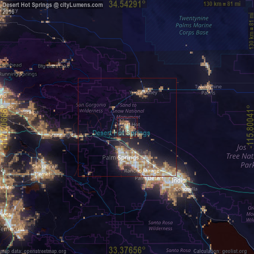
Analysis of Desert Hot Springs night lights 2016
Square area 10x10 km:
 0.87%
0.87%90-99
2.1%80-89
1.92%70-79
1.92%60-69
12.94%50-59
11.54%40-49
6.47%30-39
5.94%20-29
4.37%10-19
36.54%0-9
15.38%Square area 50x50 km:
1.48%90-99
1.93%80-89
1.45%70-79
1.6%60-69
3.97%50-59
2.43%40-49
1.65%30-39
1.86%20-29
3.16%10-19
6.82%0-9
73.65%Clear (daylight) street map image can be seen on geolist.org.
Map coordinates:
34° 32' 34.5" North, 117° 12' 24" West
33° 57' 42.2" North, 116° 30' 12.7" West
33° 22' 35.6" North, 115° 48' 1.5" West
Some cities around Desert Hot Springs sort by population:
• Cathedral City
20.5 km =12.7 mi,  170°
170°
• Palm Desert
29 km =18 mi,  156°
156°
• Palm Springs
15.1 km =9.4 mi,  194°
194°
• Yucca Valley
18.2 km =11.3 mi,  21°
21°
• Rancho Mirage
26.1 km =16.2 mi, 161°
• Thousand Palms
18.9 km =11.7 mi,  146°
146°
• Garnet
7.7 km =4.8 mi,  210°
210°
• Joshua Tree
26 km =16.2 mi,  42°
42°
5342710 (p: 28,335)
Sources (retrieved 2019-11-25):
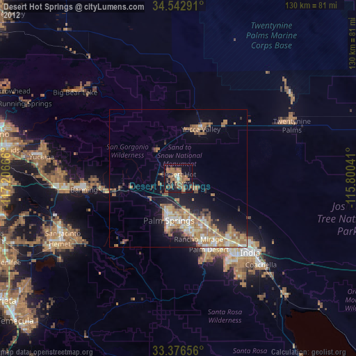
» Earth at Night: Flat Maps 2012, 2016