Auburn night lights from space
Night Light of Auburn (Alabama) from space (United States) Src. Average luminocity for 10x10km area is 75.4038% and for 50x50km: 15.8456%.
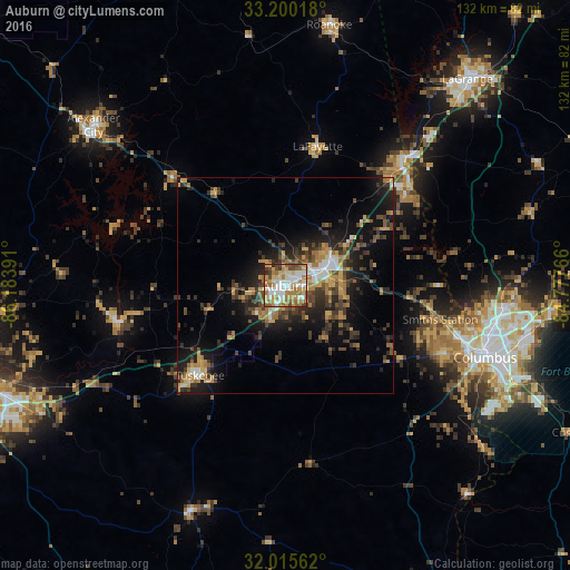

Analysis of Auburn night lights 2016
Square area 10x10 km:
 15.91%
90-99
17.48%80-89
12.94%70-79
13.46%60-69
19.23%50-59
7.17%40-49
8.74%30-39
2.8%20-29
2.1%10-19
0.17%0-9
0%Square area 50x50 km:
1.43%90-99
1.68%80-89
1.79%70-79
2.69%60-69
3.01%50-59
1.82%40-49
2.94%30-39
4%20-29
4.77%10-19
10.17%0-9
65.71%Clear (daylight) street map image can be seen on geolist.org.
Map coordinates:
33° 12' 0.6" North, 86° 11' 2.1" West
32° 36' 35.5" North, 85° 28' 50.8" West
32° 0' 56.2" North, 84° 46' 39.6" West
Some cities around Auburn sort by population:
• Columbus
49.1 km =30.5 mi,  109°
109°
• Phenix City
47.6 km =29.6 mi, 108°
• Opelika
10.4 km =6.5 mi,  67°
67°
• Alexander City
57.8 km =35.9 mi,  310°
310°
• Valley
36.5 km =22.7 mi,  50°
50°
• Tuskegee
28.5 km =17.7 mi,  223°
223°
• Lanett
39.6 km =24.6 mi,  43°
43°
• Smiths Station
36.6 km =22.7 mi,  102°
102°
4830796 (p: 62,059)
Sources (retrieved 2019-11-25):
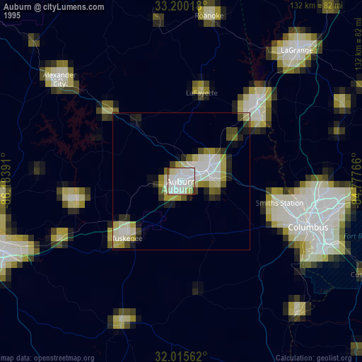
» NASA, Earths city lights 1995
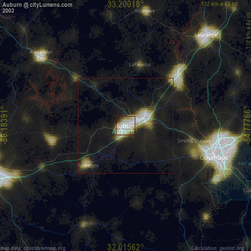
» NASA city lights 2003
» Earth at Night: Flat Maps 2012, 2016