Totowa night lights from space
Night Light of Totowa (New Jersey) from space (United States) Src. Average luminocity for 10x10km area is 92.6446% and for 50x50km: 70.9503%.
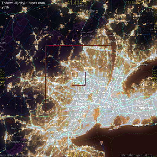
Analysis of Totowa night lights 2016
Square area 10x10 km:
 39.8%
39.8%90-99
31.8%80-89
12.59%70-79
10.54%60-69
5.1%50-59
0.17%40-49
0%30-39
0%20-29
0%10-19
0%0-9
0%Square area 50x50 km:
26.56%90-99
15.49%80-89
7.41%70-79
9.94%60-69
12.9%50-59
6.51%40-49
2.96%30-39
2.5%20-29
3.61%10-19
3.43%0-9
8.7%Clear (daylight) street map image can be seen on geolist.org.
Map coordinates:
41° 26' 3.8" North, 74° 54' 46.8" West
40° 54' 18.4" North, 74° 12' 35.5" West
40° 22' 17.6" North, 73° 30' 24.3" West
Some cities around Totowa sort by population:
• Paterson
3.5 km =2.2 mi,  67°
67°
• Wayne
6 km =3.7 mi,  291°
291°
• Woodland Park
2.1 km =1.3 mi,  143°
143°
• Little Falls
4 km =2.5 mi,  177°
177°
• North Haledon
5.9 km =3.7 mi,  19°
19°
• Haledon
3.9 km =2.4 mi,  30°
30°
• North Caldwell
6 km =3.7 mi,  222°
222°
• Prospect Park
4.6 km =2.9 mi,  40°
40°
5105455 (p: 10,973)
Sources (retrieved 2019-11-25):
» Earth at Night: Flat Maps 2012, 2016