Topsham night lights from space
Night Light of Topsham (Maine) from space (United States) Src. Average luminocity for 10x10km area is 28.227% and for 50x50km: 6.5683%.
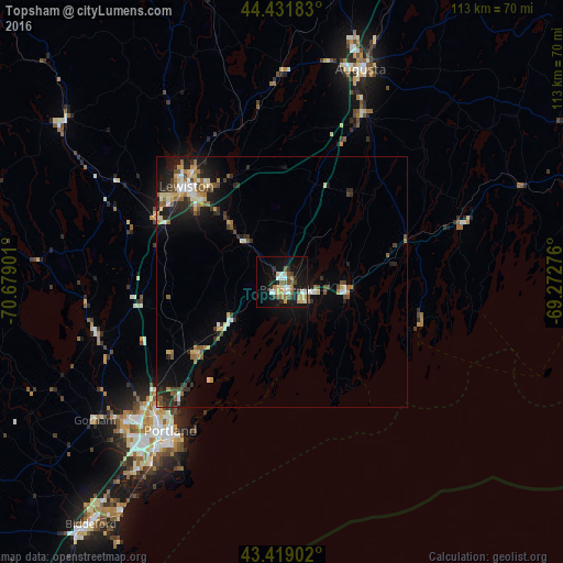
Analysis of Topsham night lights 2016
Square area 10x10 km:
 4.6%
4.6%90-99
3.97%80-89
4.92%70-79
2.38%60-69
4.13%50-59
3.17%40-49
3.97%30-39
2.86%20-29
3.97%10-19
28.41%0-9
37.62%Square area 50x50 km:
0.55%90-99
0.96%80-89
0.93%70-79
0.74%60-69
0.87%50-59
0.94%40-49
0.99%30-39
0.77%20-29
1.93%10-19
4.69%0-9
86.63%Clear (daylight) street map image can be seen on geolist.org.
Map coordinates:
44° 25' 54.6" North, 70° 40' 44.4" West
43° 55' 39.3" North, 69° 58' 33.2" West
43° 25' 8.5" North, 69° 16' 21.9" West
Some cities around Topsham sort by population:
• Lewiston
27.1 km =16.8 mi,  315°
315°
• Brunswick
1.7 km =1.1 mi,  149°
149°
• Lisbon
15.5 km =9.6 mi, 318°
• North Bath
12.8 km =8 mi,  86°
86°
• Bath
12.6 km =7.8 mi,  98°
98°
• Yarmouth
22 km =13.7 mi,  230°
230°
• New Gloucester
24.9 km =15.5 mi,  279°
279°
• Harpswell Center
14 km =8.7 mi,  182°
182°
4980927 (p: 5,931)
Sources (retrieved 2019-11-25):
» Earth at Night: Flat Maps 2012, 2016