Lewiston night lights from space
Night Light of Lewiston (Maine) from space (United States) Src. Average luminocity for 10x10km area is 52.4061% and for 50x50km: 5.6614%.
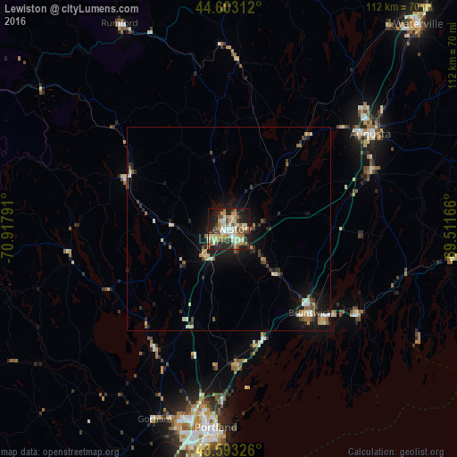
Analysis of Lewiston night lights 2016
Square area 10x10 km:
 6.21%
6.21%90-99
10.91%80-89
10%70-79
8.48%60-69
8.33%50-59
7.42%40-49
5%30-39
5.91%20-29
18.18%10-19
17.73%0-9
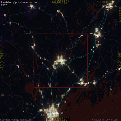
1.82%Square area 50x50 km:
0.48%90-99
0.95%80-89
0.86%70-79
0.6%60-69
0.73%50-59
0.77%40-49
0.65%30-39
0.78%20-29
1.62%10-19
4.49%0-9
88.07%Clear (daylight) street map image can be seen on geolist.org.
Map coordinates:
44° 36' 11.2" North, 70° 55' 4.5" West
44° 6' 1.3" North, 70° 12' 53.2" West
43° 35' 35.7" North, 69° 30' 42" West
Some cities around Lewiston sort by population:
• Auburn
1.3 km =0.8 mi,  258°
258°
• Brunswick
28.7 km =17.8 mi,  136°
136°
• Lisbon
11.7 km =7.3 mi,  131°
131°
• Topsham
27.1 km =16.8 mi, 135°
• Turner
17.7 km =11 mi,  349°
349°
• New Gloucester
16.2 km =10.1 mi,  199°
199°
• Poland
15 km =9.3 mi,  252°
252°
• Paris
28.9 km =18 mi,  307°
307°
4969398 (p: 36,202)
Sources (retrieved 2019-11-25):
» Earth at Night: Flat Maps 2012, 2016