Titusville night lights from space
Night Light of Titusville (Florida) from space (United States) Src. Average luminocity for 10x10km area is 45.1591% and for 50x50km: 11.055%.
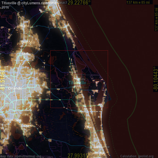
Analysis of Titusville night lights 2016
Square area 10x10 km:
 7.2%
7.2%90-99
7.77%80-89
2.84%70-79
6.06%60-69
16.29%50-59
5.3%40-49
5.3%30-39
2.84%20-29
12.31%10-19
21.21%0-9
12.88%Square area 50x50 km:
0.71%90-99
0.86%80-89
0.43%70-79
0.77%60-69
4.86%50-59
1.86%40-49
1.76%30-39
2.34%20-29
3.46%10-19
7.42%0-9
75.53%Clear (daylight) street map image can be seen on geolist.org.
Map coordinates:
29° 13' 39.6" North, 81° 30' 38.4" West
28° 36' 44" North, 80° 48' 27.2" West
27° 59' 35.3" North, 80° 6' 15.9" West
Some cities around Titusville sort by population:
• Merritt Island
15.5 km =9.6 mi,  121°
121°
• Rockledge
30.2 km =18.8 mi,  164°
164°
• Cocoa
25.9 km =16.1 mi,  165°
165°
• Port Saint John
15.2 km =9.4 mi, 173°
• Bithlo
29.9 km =18.6 mi,  257°
257°
• Mims
6.9 km =4.3 mi,  328°
328°
• Wedgefield
29.8 km =18.5 mi,  242°
242°
• Cocoa West
28.3 km =17.6 mi, 172°
4175437 (p: 45,393)
Sources (retrieved 2019-11-25):
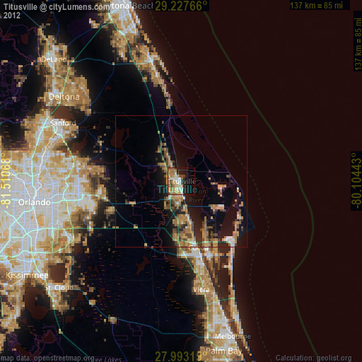
» Earth at Night: Flat Maps 2012, 2016