Tigard night lights from space
Night Light of Tigard (Oregon) from space (United States) Src. Average luminocity for 10x10km area is 83.4349% and for 50x50km: 41.8703%.
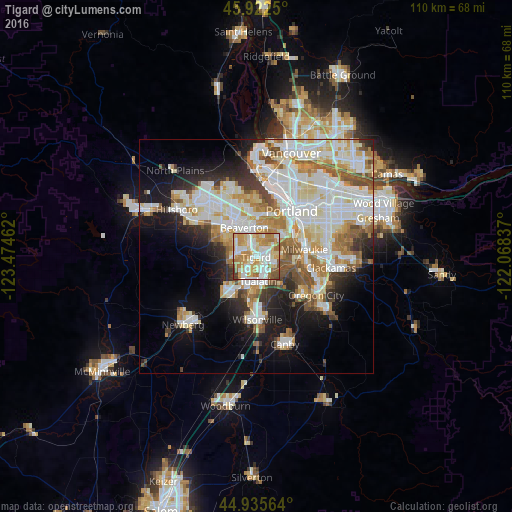
Analysis of Tigard night lights 2016
Square area 10x10 km:
 21.9%
21.9%90-99
23.81%80-89
12.7%70-79
22.06%60-69
12.22%50-59
4.44%40-49
1.43%30-39
1.43%20-29
0%10-19
0%0-9
0%Square area 50x50 km:
11.46%90-99
11.58%80-89
4.9%70-79
5%60-69
4.69%50-59
4.24%40-49
3.19%30-39
2.99%20-29
5.24%10-19
10.8%0-9
35.9%Clear (daylight) street map image can be seen on geolist.org.
Map coordinates:
45° 55' 21" North, 123° 28' 28.6" West
45° 25' 52.4" North, 122° 46' 17.4" West
44° 56' 8.3" North, 122° 4' 6.1" West
Some cities around Tigard sort by population:
• Beaverton
6.7 km =4.2 mi,  337°
337°
• Lake Oswego
8 km =5 mi,  98°
98°
• Tualatin
5.3 km =3.3 mi,  173°
173°
• Cedar Hills
8.4 km =5.2 mi,  345°
345°
• West Haven-Sylvan
9.4 km =5.8 mi,  1°
1°
• Garden Home-Whitford
3.8 km =2.4 mi,  15°
15°
• West Slope
7.5 km =4.7 mi, 4°
• Raleigh Hills
5.5 km =3.4 mi,  7°
7°
5756758 (p: 51,253)
Sources (retrieved 2019-11-25):
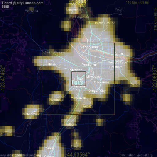
» NASA, Earths city lights 1995
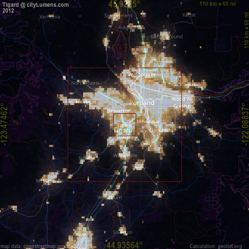
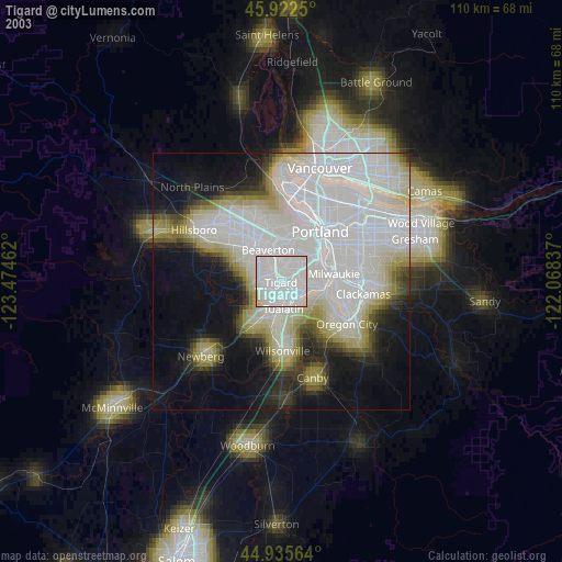
» NASA city lights 2003
» Earth at Night: Flat Maps 2012, 2016