Tualatin night lights from space
Night Light of Tualatin (Oregon) from space (United States) Src. Average luminocity for 10x10km area is 69.0524% and for 50x50km: 37.7722%.
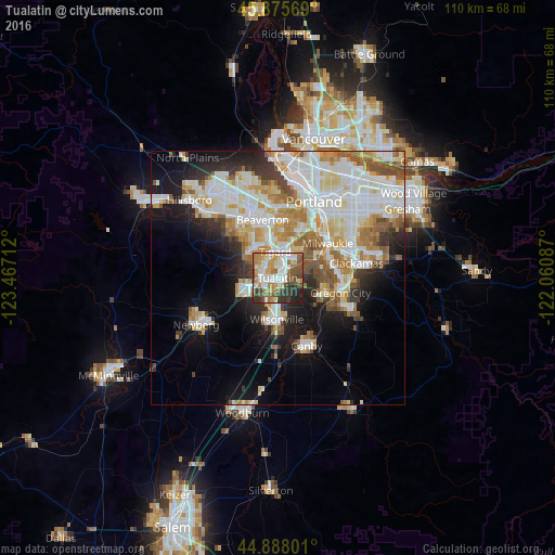
Analysis of Tualatin night lights 2016
Square area 10x10 km:
 16.83%
90-99
17.14%80-89
5.4%70-79
13.33%60-69
10.16%50-59
10%40-49
7.46%30-39
11.27%20-29
7.14%10-19
1.27%0-9
0%Square area 50x50 km:
10.04%90-99
10.1%80-89
4.38%70-79
4.65%60-69
4.36%50-59
4.01%40-49
2.91%30-39
2.89%20-29
5.03%10-19
10.78%0-9
40.87%Clear (daylight) street map image can be seen on geolist.org.
Map coordinates:
45° 52' 32.5" North, 123° 28' 1.6" West
45° 23' 2.4" North, 122° 45' 50.4" West
44° 53' 16.8" North, 122° 3' 39.1" West
Some cities around Tualatin sort by population:
• Tigard
5.3 km =3.3 mi,  353°
353°
• Lake Oswego
8.3 km =5.2 mi,  60°
60°
• Wilsonville
9.4 km =5.8 mi,  184°
184°
• Sherwood
6.7 km =4.2 mi,  242°
242°
• Oak Grove
10.3 km =6.4 mi,  69°
69°
• Jennings Lodge
11.8 km =7.3 mi,  86°
86°
• Garden Home-Whitford
8.9 km =5.5 mi,  2°
2°
• Raleigh Hills
10.7 km =6.6 mi, 0°
5757506 (p: 27,154)
Sources (retrieved 2019-11-25):
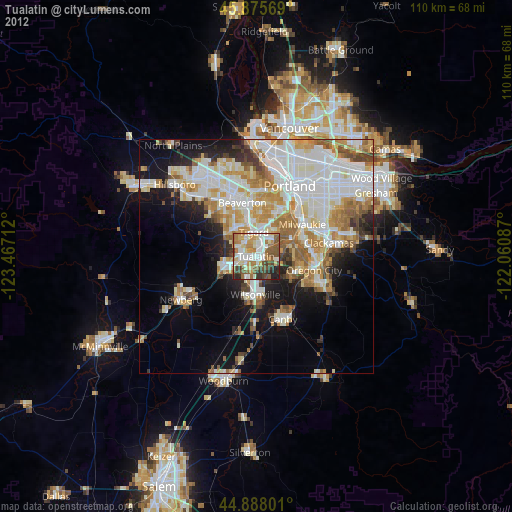
» Earth at Night: Flat Maps 2012, 2016