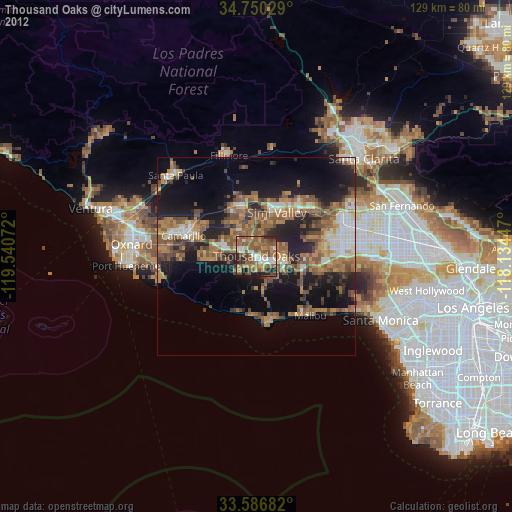
Thousand Oaks night lights from space
Night Light of Thousand Oaks (California) from space (United States) Src. Average luminocity for 10x10km area is 60.7344% and for 50x50km: 26.8565%.

Analysis of Thousand Oaks night lights 2016
Square area 10x10 km:
 5.86%
5.86%90-99
8.97%80-89
5.68%70-79
6.59%60-69
17.4%50-59
26.01%40-49
15.2%30-39
8.79%20-29
5.49%10-19
0%0-9
0%Square area 50x50 km:
2.59%90-99
2.86%80-89
1.76%70-79
3.06%60-69
7.2%50-59
6.54%40-49
6.42%30-39
5.27%20-29
8.16%10-19
13.36%0-9
42.78%Clear (daylight) street map image can be seen on geolist.org.
Map coordinates:
34° 45' 1" North, 119° 32' 26.6" West
34° 10' 14" North, 118° 50' 15.3" West
33° 35' 12.6" North, 118° 8' 4.1" West
Some cities around Thousand Oaks sort by population:
• Simi Valley
12.1 km =7.5 mi,  25°
25°
• West Hills
18.1 km =11.2 mi,  80°
80°
• Moorpark
13.4 km =8.3 mi,  342°
342°
• Agoura Hills
6.9 km =4.3 mi,  123°
123°
• Agoura
9.7 km =6 mi,  108°
108°
• Oak Park
6.9 km =4.3 mi, 82°
• Malibu
16.9 km =10.5 mi,  161°
161°
• Westlake Village
4 km =2.5 mi,  133°
133°
5402405 (p: 129,339)
Sources (retrieved 2019-11-25):
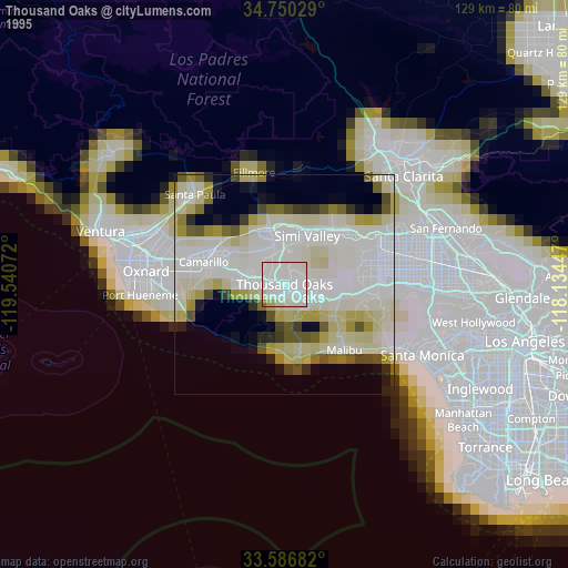
» NASA, Earths city lights 1995
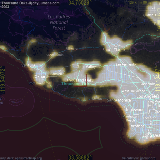
» NASA city lights 2003
» Earth at Night: Flat Maps 2012, 2016