Moorpark night lights from space
Night Light of Moorpark (California) from space (United States) Src. Average luminocity for 10x10km area is 41.7234% and for 50x50km: 25.7762%.
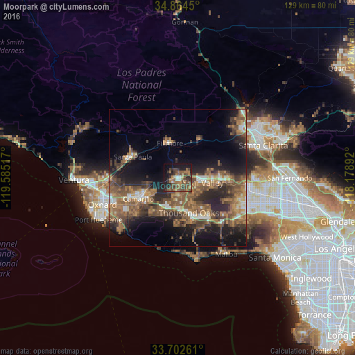
Analysis of Moorpark night lights 2016
Square area 10x10 km:
 1.28%
1.28%90-99
3.11%80-89
2.93%70-79
4.95%60-69
14.1%50-59
11.36%40-49
16.3%30-39
10.07%20-29
7.33%10-19
22.16%0-9
6.41%Square area 50x50 km:
1.92%90-99
2.39%80-89
1.6%70-79
3.18%60-69
7.35%50-59
6.84%40-49
6.47%30-39
5.39%20-29
7.76%10-19
13.24%0-9
43.83%Clear (daylight) street map image can be seen on geolist.org.
Map coordinates:
34° 51' 52.2" North, 119° 35' 6.6" West
34° 17' 8" North, 118° 52' 55.3" West
33° 42' 9.4" North, 118° 10' 44.1" West
Some cities around Moorpark sort by population:
• Thousand Oaks
13.4 km =8.3 mi,  162°
162°
• Simi Valley
9.4 km =5.8 mi,  100°
100°
• Camarillo
16.2 km =10.1 mi,  241°
241°
• Santa Paula
18 km =11.2 mi,  295°
295°
• Agoura Hills
19.3 km =12 mi,  149°
149°
• Fillmore
13.1 km =8.1 mi,  345°
345°
• Oak Park
16.1 km =10 mi,  137°
137°
• Westlake Village
17 km =10.6 mi, 155°
5374648 (p: 36,104)
Sources (retrieved 2019-11-25):
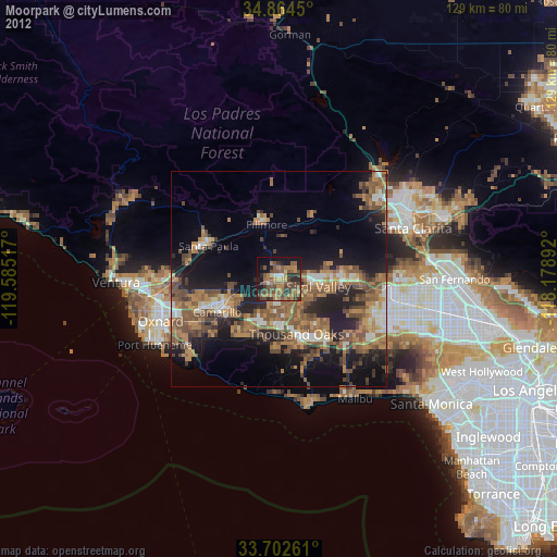
» Earth at Night: Flat Maps 2012, 2016