Thomaston night lights from space
Night Light of Thomaston (Georgia) from space (United States) Src. Average luminocity for 10x10km area is 35.7088% and for 50x50km: 4.4939%.
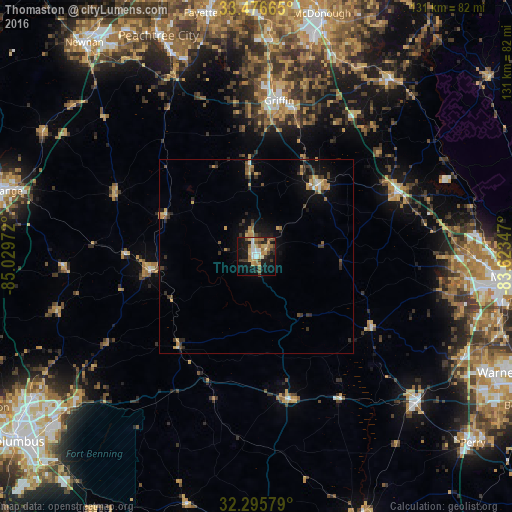
Analysis of Thomaston night lights 2016
Square area 10x10 km:
 4.03%
4.03%90-99
5.13%80-89
5.86%70-79
6.23%60-69
5.86%50-59
5.31%40-49
3.85%30-39
5.31%20-29
5.86%10-19
33.33%0-9
19.23%Square area 50x50 km:
0.25%90-99
0.38%80-89
0.61%70-79
0.92%60-69
0.58%50-59
0.54%40-49
0.69%30-39
1.07%20-29
0.91%10-19
3.5%0-9
90.55%Clear (daylight) street map image can be seen on geolist.org.
Map coordinates:
33° 28' 35.9" North, 85° 1' 47" West
32° 53' 17.5" North, 84° 19' 35.7" West
32° 17' 44.8" North, 83° 37' 24.5" West
Some cities around Thomaston sort by population:
• Peachtree City
61.9 km =38.5 mi,  336°
336°
• Griffin
40.3 km =25 mi,  8°
8°
• Fort Valley
55.4 km =34.4 mi,  132°
132°
• Hampton
55.6 km =34.5 mi,  4°
4°
• Barnesville
24.4 km =15.2 mi,  40°
40°
• Lovejoy
60.9 km =37.8 mi, 1°
• Locust Grove
54.8 km =34.1 mi,  21°
21°
• Byron
59.1 km =36.7 mi,  116°
116°
4226364 (p: 9,032)
Sources (retrieved 2019-11-25):
» Earth at Night: Flat Maps 2012, 2016