Lovejoy night lights from space
Night Light of Lovejoy (Georgia) from space (United States) Src. Average luminocity for 10x10km area is 60.979% and for 50x50km: 58.3973%.
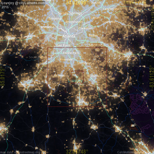
Analysis of Lovejoy night lights 2016
Square area 10x10 km:
 3.15%
3.15%90-99
7.17%80-89
6.64%70-79
14.51%60-69
17.13%50-59
21.33%40-49
18.36%30-39
8.57%20-29
3.15%10-19
0%0-9
0%Square area 50x50 km:
8.86%90-99
9.38%80-89
8.3%70-79
13.58%60-69
13.58%50-59
9.94%40-49
8.72%30-39
7.66%20-29
6.3%10-19
6.39%0-9
7.3%Clear (daylight) street map image can be seen on geolist.org.
Map coordinates:
34° 1' 15.6" North, 85° 1' 3" West
33° 26' 10.4" North, 84° 18' 51.7" West
32° 50' 50.9" North, 83° 36' 40.5" West
Some cities around Lovejoy sort by population:
• Stockbridge
14.1 km =8.8 mi,  31°
31°
• McDonough
15.6 km =9.7 mi,  85°
85°
• Forest Park
21.3 km =13.2 mi,  346°
346°
• Fayetteville
13.1 km =8.1 mi,  276°
276°
• Riverdale
17.7 km =11 mi,  328°
328°
• Irondale
6.4 km =4 mi,  320°
320°
• Hampton
6.2 km =3.9 mi,  151°
151°
• Morrow
16.5 km =10.3 mi, 351°
4206905 (p: 6,487)
Sources (retrieved 2019-11-25):
» Earth at Night: Flat Maps 2012, 2016