The Village of Indian Hill night lights from space
Night Light of The Village of Indian Hill (Ohio) from space (United States) Src. Average luminocity for 10x10km area is 67.9659% and for 50x50km: 56.0248%.
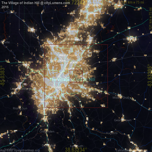
Analysis of The Village of Indian Hill night lights 2016
Square area 10x10 km:
 5.84%
5.84%90-99
12.01%80-89
10.39%70-79
11.85%60-69
19.48%50-59
29.06%40-49
9.9%30-39
1.46%20-29
0%10-19
0%0-9
0%Square area 50x50 km:
11.67%90-99
13.1%80-89
8.57%70-79
10.79%60-69
9.97%50-59
8.06%40-49
4.08%30-39
3.44%20-29
4.72%10-19
6.9%0-9
18.7%Clear (daylight) street map image can be seen on geolist.org.
Map coordinates:
39° 43' 20.7" North, 85° 2' 17.9" West
39° 10' 46.2" North, 84° 20' 6.6" West
38° 37' 56.4" North, 83° 37' 55.4" West
Some cities around The Village of Indian Hill sort by population:
• Blue Ash
6.9 km =4.3 mi,  327°
327°
• Montgomery
5.6 km =3.5 mi,  343°
343°
• Madeira
2.8 km =1.7 mi,  297°
297°
• Dry Run
8.4 km =5.2 mi,  177°
177°
• Kenwood
4.4 km =2.7 mi,  321°
321°
• Milford
3.5 km =2.2 mi,  97°
97°
• Deer Park
5.9 km =3.7 mi, 299°
• Turpin Hills
8.6 km =5.3 mi,  206°
206°
4526225 (p: 5,798)
Sources (retrieved 2019-11-25):
» Earth at Night: Flat Maps 2012, 2016