Country Walk night lights from space
Night Light of Country Walk (Florida) from space (United States) Src. Average luminocity for 10x10km area is 86.5038% and for 50x50km: 42.487%.
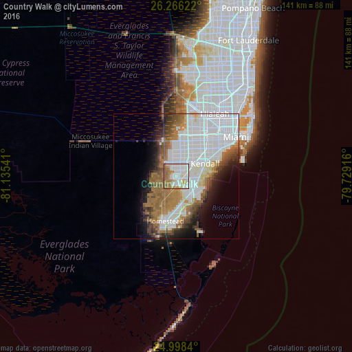
Analysis of Country Walk night lights 2016
Square area 10x10 km:
 35.04%
90-99
24.05%80-89
7.58%70-79
8.14%60-69
16.86%50-59
8.33%40-49
0%30-39
0%20-29
0%10-19
0%0-9
0%Square area 50x50 km:
18.87%90-99
7.79%80-89
2.31%70-79
1.8%60-69
8.26%50-59
4.59%40-49
3.56%30-39
3.16%20-29
3.82%10-19
6.37%0-9
39.48%Clear (daylight) street map image can be seen on geolist.org.
Map coordinates:
26° 15' 58.4" North, 81° 8' 7.5" West
25° 38' 2.4" North, 80° 25' 56.2" West
24° 59' 54.2" North, 79° 43' 45" West
Some cities around Country Walk sort by population:
• The Hammocks
4.3 km =2.7 mi,  343°
343°
• South Miami Heights
6.6 km =4.1 mi,  127°
127°
• Richmond West
2.6 km =1.6 mi,  174°
174°
• The Crossings
5.1 km =3.2 mi,  37°
37°
• Three Lakes
3.5 km =2.2 mi,  75°
75°
• Palmetto Estates
7.2 km =4.5 mi,  101°
101°
• West Perrine
7.6 km =4.7 mi,  114°
114°
• Richmond Heights
6.4 km =4 mi,  92°
92°
4152064 (p: 15,997)
Sources (retrieved 2019-11-25):
» Earth at Night: Flat Maps 2012, 2016