Wellington night lights from space
Night Light of Wellington (Florida) from space (United States) Src. Average luminocity for 10x10km area is 79.3902% and for 50x50km: 41.1824%.
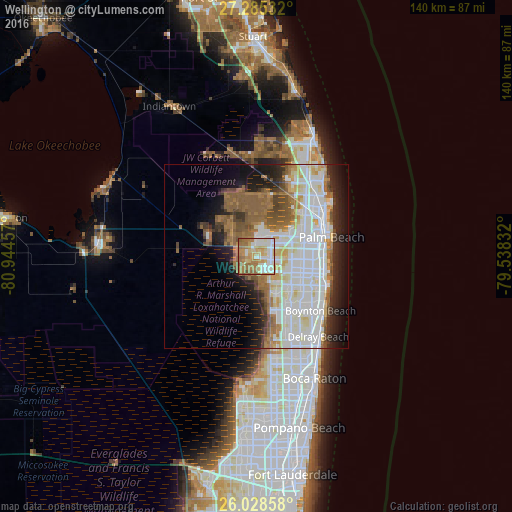
Analysis of Wellington night lights 2016
Square area 10x10 km:
 16.86%
90-99
20.64%80-89
10.8%70-79
12.69%60-69
28.22%50-59
9.28%40-49
1.33%30-39
0%20-29
0%10-19
0.19%0-9
0%Square area 50x50 km:
11.76%90-99
11.4%80-89
3.81%70-79
2.82%60-69
6.6%50-59
6.17%40-49
3.46%30-39
2.62%20-29
5.39%10-19
8.81%0-9
37.15%Clear (daylight) street map image can be seen on geolist.org.
Map coordinates:
27° 17' 7.2" North, 80° 56' 40.5" West
26° 39' 31.2" North, 80° 14' 29.2" West
26° 1' 42.9" North, 79° 32' 18" West
Some cities around Wellington sort by population:
• West Palm Beach
19.7 km =12.2 mi,  71°
71°
• The Acreage
15.3 km =9.5 mi,  350°
350°
• Royal Palm Beach
5.6 km =3.5 mi,  11°
11°
• Lake Worth
17.4 km =10.8 mi,  105°
105°
• Greenacres City
12.2 km =7.6 mi, 108°
• Palm Springs
14.7 km =9.1 mi,  99°
99°
• Lake Worth Corridor
14.7 km =9.1 mi, 108°
• West Gate
15.1 km =9.4 mi, 71°
4177703 (p: 62,560)
Sources (retrieved 2019-11-25):
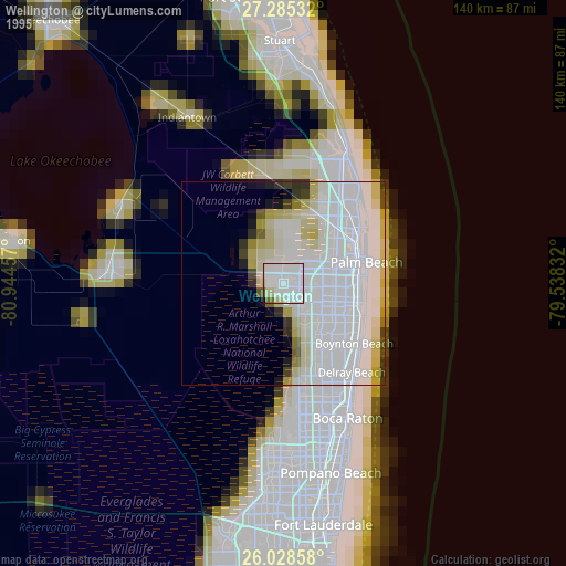
» NASA, Earths city lights 1995
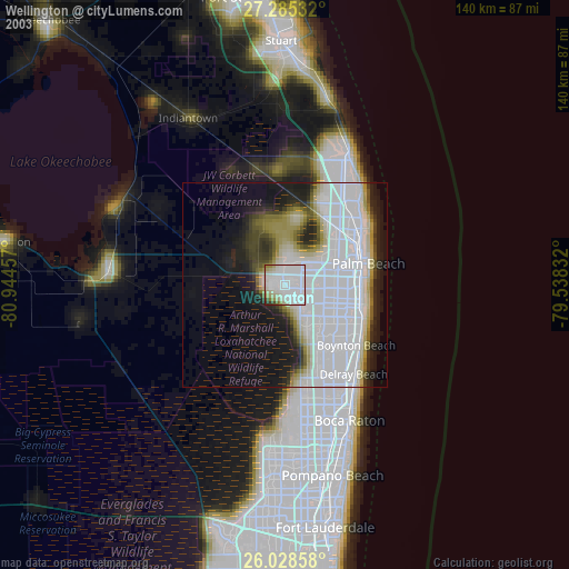
» NASA city lights 2003
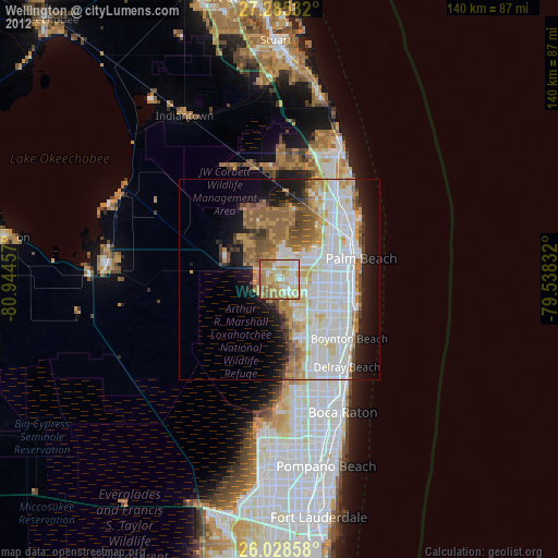
» Earth at Night: Flat Maps 2012, 2016