Riviera Beach night lights from space
Night Light of Riviera Beach (Florida) from space (United States) Src. Average luminocity for 10x10km area is 78.371% and for 50x50km: 35.9519%.
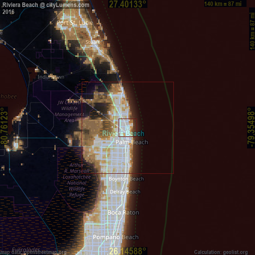
Analysis of Riviera Beach night lights 2016
Square area 10x10 km:
 36.9%
36.9%90-99
23.61%80-89
6.94%70-79
2.98%60-69
3.77%50-59
2.98%40-49
2.18%30-39
5.56%20-29
13.29%10-19
1.79%0-9
0%Square area 50x50 km:
8.73%90-99
9.4%80-89
3.65%70-79
3.06%60-69
6.83%50-59
6.34%40-49
3.41%30-39
2.16%20-29
4.87%10-19
8.1%0-9
43.46%Clear (daylight) street map image can be seen on geolist.org.
Map coordinates:
27° 24' 4.8" North, 80° 45' 40.4" West
26° 46' 31.2" North, 80° 3' 29.2" West
26° 8' 45.2" North, 79° 21' 17.9" West
Some cities around Riviera Beach sort by population:
• West Palm Beach
6.7 km =4.2 mi,  175°
175°
• Palm Beach Gardens
9.6 km =6 mi,  303°
303°
• Lake Worth
17.7 km =11 mi, 184°
• Palm Springs
16 km =9.9 mi,  193°
193°
• North Palm Beach
5.3 km =3.3 mi,  333°
333°
• Palm Beach
8 km =5 mi,  164°
164°
• Lake Park
2.9 km =1.8 mi,  343°
343°
• West Gate
9 km =5.6 mi,  206°
206°
4170174 (p: 34,005)
Sources (retrieved 2019-11-25):
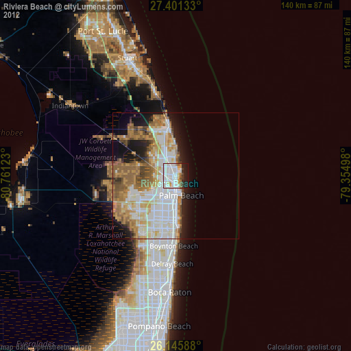
» Earth at Night: Flat Maps 2012, 2016