Terrell night lights from space
Night Light of Terrell (Texas) from space (United States) Src. Average luminocity for 10x10km area is 47.0699% and for 50x50km: 21.8622%.
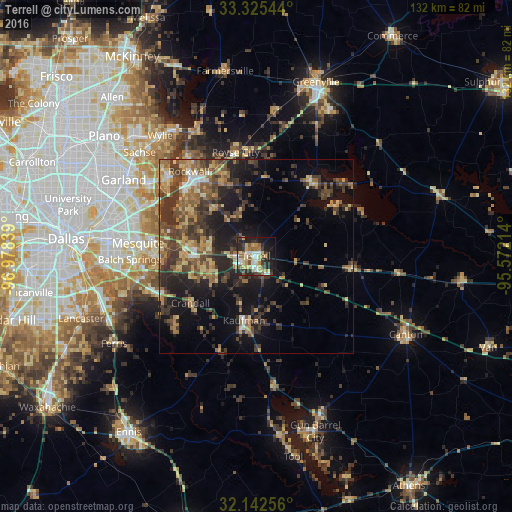
Analysis of Terrell night lights 2016
Square area 10x10 km:
 7.17%
7.17%90-99
7.69%80-89
9.09%70-79
6.29%60-69
6.82%50-59
7.34%40-49
3.15%30-39
9.09%20-29
16.08%10-19
21.33%0-9
5.94%Square area 50x50 km:
1.05%90-99
1.35%80-89
3.53%70-79
2.98%60-69
4.04%50-59
4.22%40-49
4.61%30-39
8.23%20-29
6.45%10-19
12.64%0-9
50.9%Clear (daylight) street map image can be seen on geolist.org.
Map coordinates:
33° 19' 31.6" North, 96° 58' 42.2" West
32° 44' 9.5" North, 96° 16' 30.9" West
32° 8' 33.2" North, 95° 34' 19.7" West
Some cities around Terrell sort by population:
• Rockwall
27.7 km =17.2 mi,  321°
321°
• Forney
18.4 km =11.4 mi,  274°
274°
• Seagoville
26.8 km =16.7 mi,  246°
246°
• Royse City
27.1 km =16.8 mi,  348°
348°
• Fate
24.9 km =15.5 mi,  336°
336°
• Heath
21.8 km =13.5 mi,  300°
300°
• Kaufman
16.6 km =10.3 mi,  190°
190°
• Sunnyvale
27.5 km =17.1 mi,  284°
284°
4736028 (p: 16,981)
Sources (retrieved 2019-11-25):
» Earth at Night: Flat Maps 2012, 2016