Sunnyvale night lights from space
Night Light of Sunnyvale (Texas) from space (United States) Src. Average luminocity for 10x10km area is 69.3706% and for 50x50km: 63.4625%.
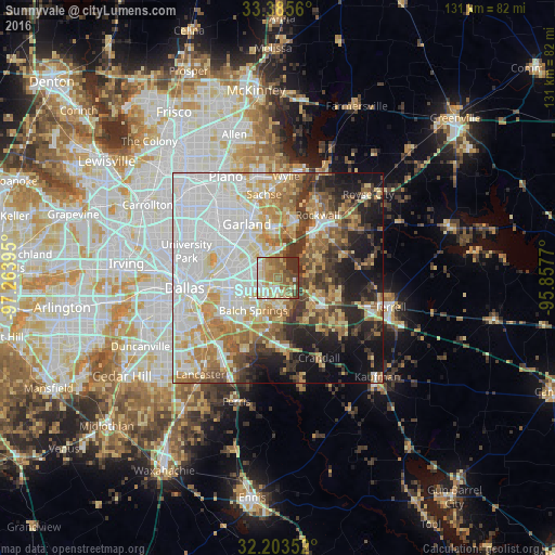
Analysis of Sunnyvale night lights 2016
Square area 10x10 km:
 10.31%
90-99
13.11%80-89
13.81%70-79
13.11%60-69
16.26%50-59
12.24%40-49
8.22%30-39
11.54%20-29
1.4%10-19
0%0-9
0%Square area 50x50 km:
18.98%90-99
14.71%80-89
8.51%70-79
7.73%60-69
8.53%50-59
6.47%40-49
5.27%30-39
7.51%20-29
6.21%10-19
10.65%0-9
5.42%Clear (daylight) street map image can be seen on geolist.org.
Map coordinates:
33° 23' 8.2" North, 97° 15' 50.2" West
32° 47' 47.5" North, 96° 33' 39" West
32° 12' 12.7" North, 95° 51' 27.7" West
Some cities around Sunnyvale sort by population:
• Garland
14.8 km =9.2 mi,  330°
330°
• Mesquite
4.9 km =3 mi,  227°
227°
• Rowlett
11.8 km =7.3 mi,  358°
358°
• Rockwall
17.7 km =11 mi,  32°
32°
• Balch Springs
9.5 km =5.9 mi,  217°
217°
• Forney
9.9 km =6.2 mi,  122°
122°
• Seagoville
17.6 km =10.9 mi,  173°
173°
• Heath
9.2 km =5.7 mi,  60°
60°
4735013 (p: 6,044)
Sources (retrieved 2019-11-25):
» Earth at Night: Flat Maps 2012, 2016