Rockwall night lights from space
Night Light of Rockwall (Texas) from space (United States) Src. Average luminocity for 10x10km area is 63.7326% and for 50x50km: 48.9388%.

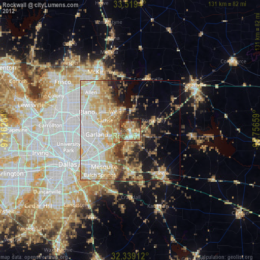
Analysis of Rockwall night lights 2016
Square area 10x10 km:
 9.52%
9.52%90-99
12.64%80-89
4.76%70-79
10.44%60-69
11.54%50-59
18.86%40-49
14.29%30-39
15.75%20-29
2.2%10-19
0%0-9
0%Square area 50x50 km:
10.71%90-99
11.2%80-89
8.04%70-79
6.59%60-69
7.08%50-59
5.72%40-49
4.44%30-39
7.32%20-29
5.61%10-19
10.08%0-9
23.21%Clear (daylight) street map image can be seen on geolist.org.
Map coordinates:
33° 31' 9.8" North, 97° 9' 46.2" West
32° 55' 52.4" North, 96° 27' 35" West
32° 20' 20.8" North, 95° 45' 23.7" West
Some cities around Rockwall sort by population:
• Garland
16.9 km =10.5 mi,  262°
262°
• Rowlett
10.2 km =6.3 mi,  252°
252°
• Wylie
11.9 km =7.4 mi,  321°
321°
• Sachse
13.6 km =8.5 mi,  291°
291°
• Murphy
17.1 km =10.6 mi,  303°
303°
• Royse City
12.8 km =8 mi,  67°
67°
• Fate
7.4 km =4.6 mi,  81°
81°
• Heath
10.6 km =6.6 mi,  187°
187°
4723406 (p: 42,566)
Sources (retrieved 2019-11-25):
» Earth at Night: Flat Maps 2012, 2016