Tempe night lights from space
Night Light of Tempe (Arizona) from space (United States) Src. Average luminocity for 10x10km area is 96.4983% and for 50x50km: 70.7944%.
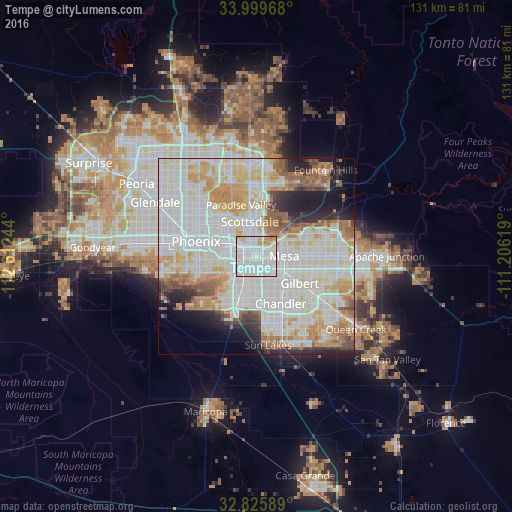
Analysis of Tempe night lights 2016
Square area 10x10 km:
 50.87%
90-99
37.41%80-89
3.85%70-79
5.77%60-69
1.75%50-59
0.35%40-49
0%30-39
0%20-29
0%10-19
0%0-9
0%Square area 50x50 km:
25.46%90-99
22.01%80-89
8.13%70-79
8.05%60-69
6.44%50-59
4.76%40-49
2.64%30-39
2.61%20-29
4.94%10-19
6.13%0-9
8.83%Clear (daylight) street map image can be seen on geolist.org.
Map coordinates:
33° 59' 58.8" North, 112° 36' 44.8" West
33° 24' 53.2" North, 111° 54' 33.5" West
32° 49' 33.2" North, 111° 12' 22.3" West
Some cities around Tempe sort by population:
• Mesa
8.1 km =5 mi,  84°
84°
• Chandler
13.6 km =8.5 mi,  152°
152°
• Gilbert
13.1 km =8.1 mi,  121°
121°
• Scottsdale
10.5 km =6.5 mi,  5°
5°
• Ahwatukee Foothills
10.7 km =6.6 mi,  220°
220°
• Central City
14.1 km =8.8 mi,  281°
281°
• Paradise Valley
13.3 km =8.3 mi,  346°
346°
• Guadalupe
7 km =4.3 mi,  225°
225°
5317058 (p: 175,826)
Sources (retrieved 2019-11-25):
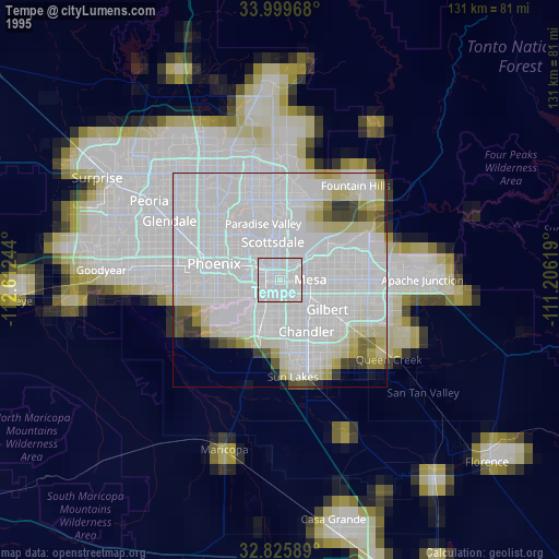
» NASA, Earths city lights 1995
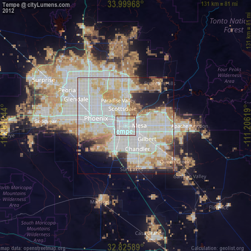
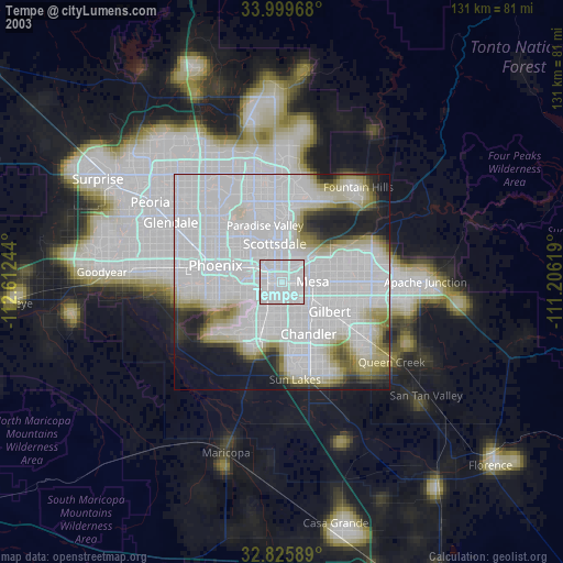
» NASA city lights 2003
» Earth at Night: Flat Maps 2012, 2016