Guadalupe night lights from space
Night Light of Guadalupe (Arizona) from space (United States) Src. Average luminocity for 10x10km area is 94.4353% and for 50x50km: 63.4624%.
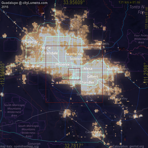
Analysis of Guadalupe night lights 2016
Square area 10x10 km:
 44.41%
90-99
34.09%80-89
9.79%70-79
9.27%60-69
2.45%50-59
0%40-49
0%30-39
0%20-29
0%10-19
0%0-9
0%Square area 50x50 km:
24.7%90-99
20.33%80-89
6.03%70-79
6.23%60-69
5.39%50-59
3.35%40-49
1.99%30-39
2.09%20-29
4.65%10-19
6.7%0-9
18.55%Clear (daylight) street map image can be seen on geolist.org.
Map coordinates:
33° 57' 21.9" North, 112° 39' 57.8" West
33° 22' 15.2" North, 111° 57' 46.5" West
32° 46' 54.1" North, 111° 15' 35.3" West
Some cities around Guadalupe sort by population:
• Phoenix
13.4 km =8.3 mi,  309°
309°
• Mesa
14.2 km =8.8 mi,  66°
66°
• Chandler
13.4 km =8.3 mi,  122°
122°
• Tempe
7 km =4.3 mi,  45°
45°
• Tempe Junction
5.1 km =3.2 mi,  20°
20°
• Ahwatukee Foothills
3.8 km =2.4 mi,  211°
211°
• Central City
11.7 km =7.3 mi, 311°
• Encanto
16.1 km =10 mi,  318°
318°
5296962 (p: 6,177)
Sources (retrieved 2019-11-25):
» Earth at Night: Flat Maps 2012, 2016