Central City night lights from space
Night Light of Central City (Arizona) from space (United States) Src. Average luminocity for 10x10km area is 98.0909% and for 50x50km: 71.0701%.
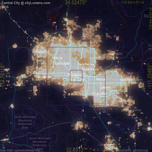
Analysis of Central City night lights 2016
Square area 10x10 km:
 73.08%
90-99
17.83%80-89
7.52%70-79
1.57%60-69
0%50-59
0%40-49
0%30-39
0%20-29
0%10-19
0%0-9
0%Square area 50x50 km:
27.02%90-99
22.19%80-89
8.4%70-79
8.97%60-69
5.75%50-59
3.26%40-49
2.05%30-39
1.83%20-29
3.7%10-19
4.04%0-9
12.78%Clear (daylight) street map image can be seen on geolist.org.
Map coordinates:
34° 1' 29.1" North, 112° 45' 40.2" West
33° 26' 24" North, 112° 3' 29" West
32° 51' 4.7" North, 111° 21' 17.7" West
Some cities around Central City sort by population:
• Phoenix
1.8 km =1.1 mi,  302°
302°
• Maryvale
13.1 km =8.1 mi, 301°
• Tempe Junction
11 km =6.8 mi,  105°
105°
• Alhambra
9.6 km =6 mi,  312°
312°
• Ahwatukee Foothills
12.9 km =8 mi,  147°
147°
• Encanto
4.8 km =3 mi,  336°
336°
• Guadalupe
11.7 km =7.3 mi,  131°
131°
• Laveen
13.4 km =8.3 mi,  230°
230°
11979238 (p: 58,161)
Sources (retrieved 2019-11-25):
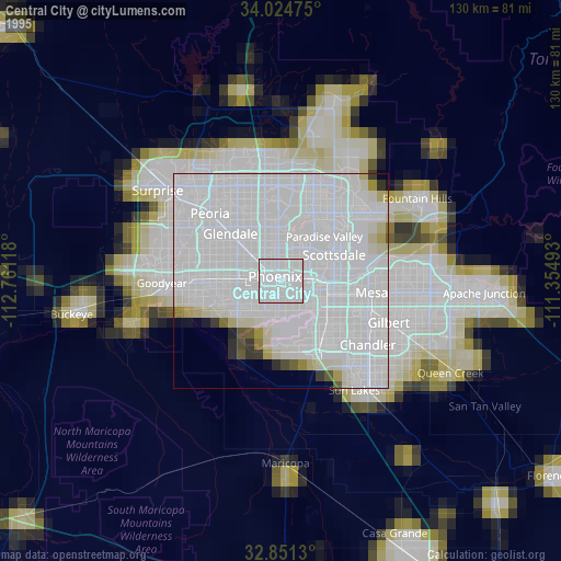
» NASA, Earths city lights 1995
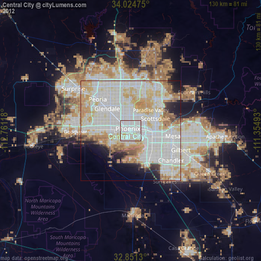
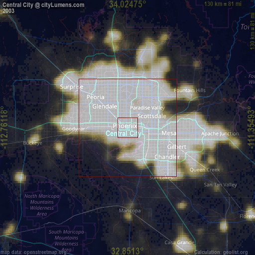
» NASA city lights 2003
» Earth at Night: Flat Maps 2012, 2016